Feathered Changes
Outdoor permanent floor-piece
Los Angeles County Museum of Art, California, USA
Under construction, Opening April 2026
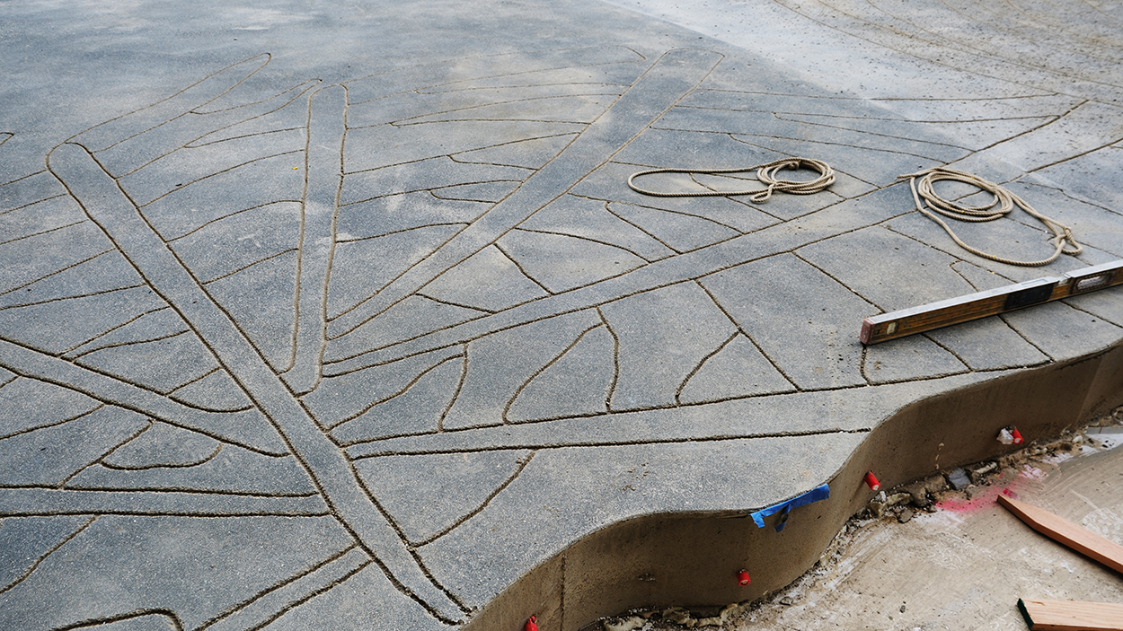
Feathered Changes, 2024
Outdoor permanent floorpiece
Low-relief drawings on concrete surface with balck aggregates
LACMA, Los Angeles, USA
LACMA sits on land that was a nourishing marshy ecosystem for thousands of years. The location produced a trove of fossils discovered during site preparation for the David Geffen Galleries. To connect the new building by Peter Zumthor to the soil it stands on, artist Mariana Castillo Deball is creating the commissioned artwork Feathered Changes, which will spread over 75,000 square feet of the campus in an expansive meditation on time, geologic history, and the LACMA site.
A series of “islands” scattered across the east campus will be surrounded by a brushed pattern inscribed into the Plaza with a method closely related to the way concrete is textured before it is set with a broom or rake, and the techniques used in dry Zen gardens to create patterns in sand, reflecting possible circulation routes throughout the plaza and the organic shape of the David Geffen Galleries. The concrete islands are imprinted with fragments of the artist’s feathered serpent drawings, based on fragments of ancient murals from Teotihuacan. The Feathered Serpent is an ancient Mesoamerican symbol representing the connection between the earth and the sun, soil and water, place and transformation. The landscape of the installation will also be inscribed with animal tracks native to California, creating an organic drawing on the surface of the huge ground plane. With Feathered Changes, Castillo Deball acknowledges the many Indigenous people of the Los Angeles area and their connections to the larger indigenous histories in our continent.
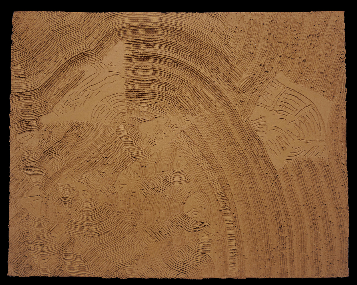
Feathered Changes, 2024
Test phase, Ceramic model
LACMA, Los Angeles, USA
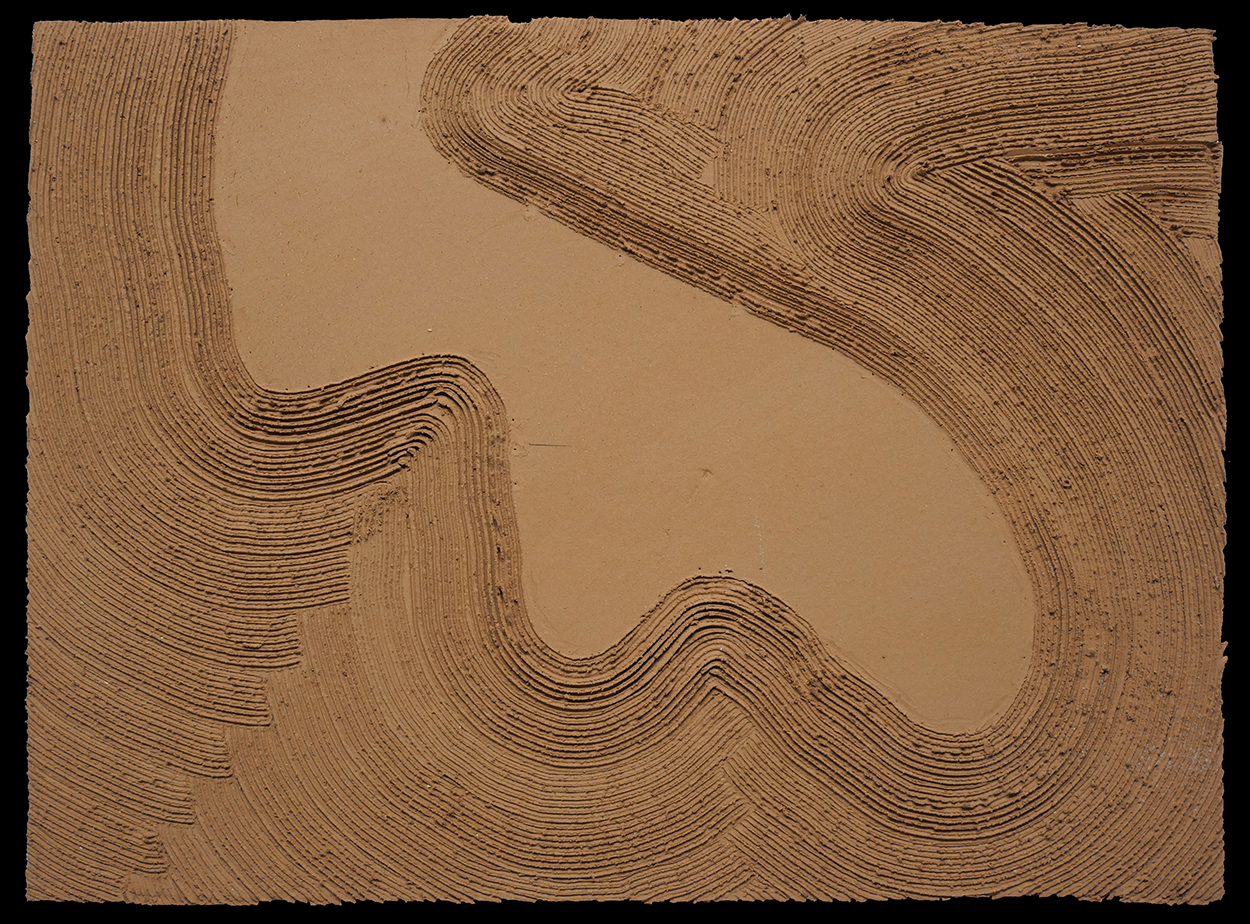
Feathered Changes, 2024
Test phase, Ceramic model
LACMA, Los Angeles, USA
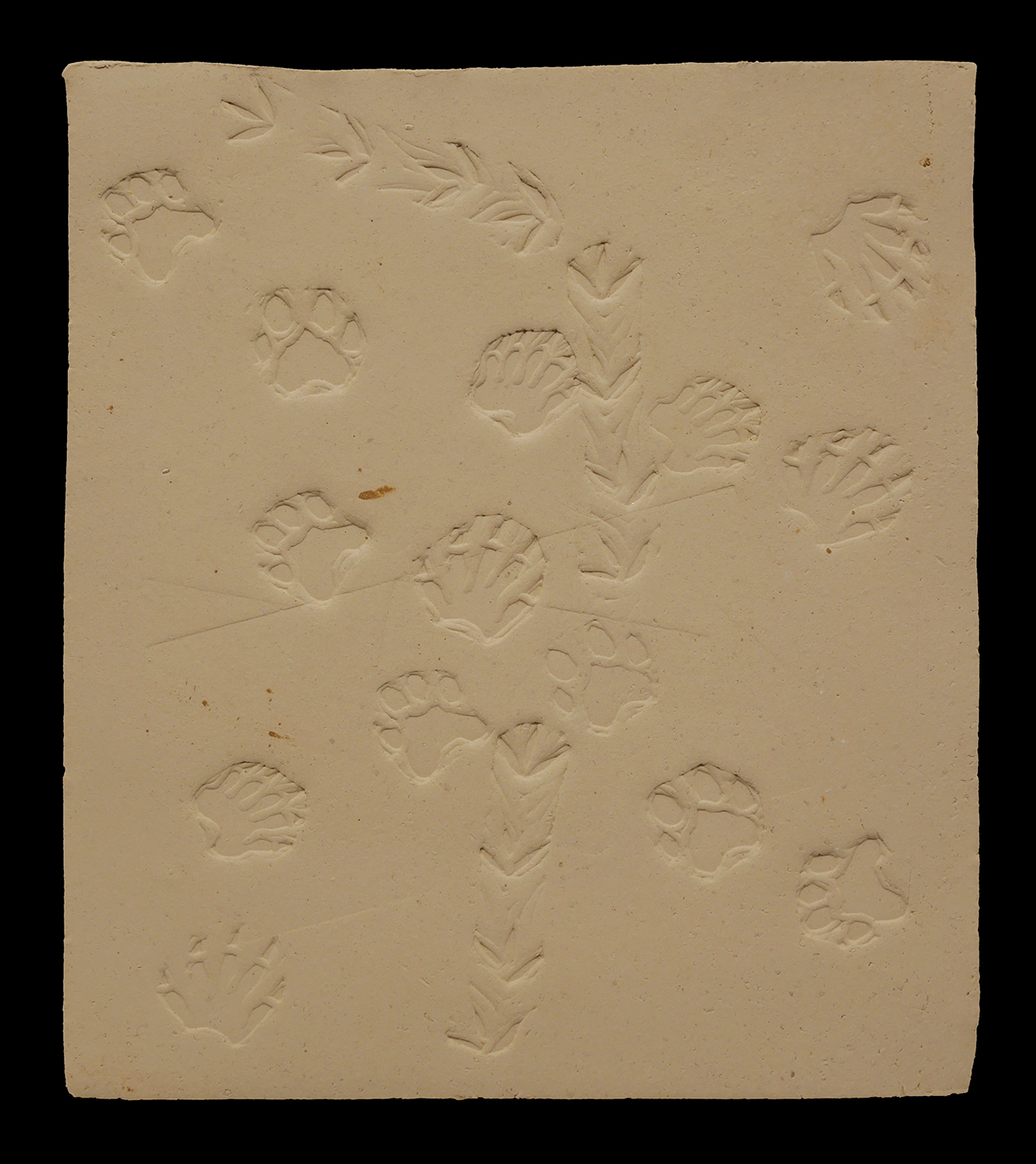
Feathered Changes, 2024
Test phase, Ceramic model
LACMA, Los Angeles, USA
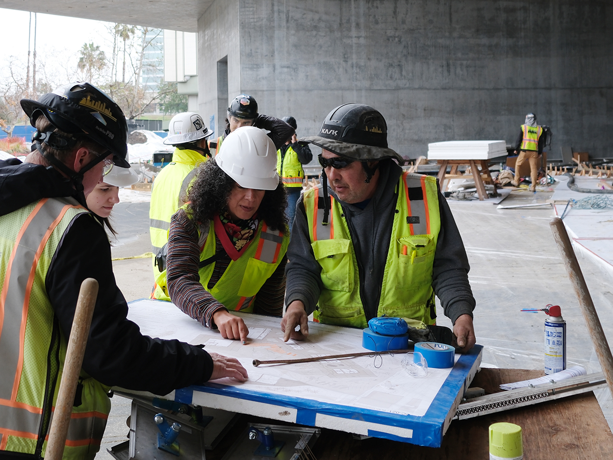
Mariana Castillo Deball and the construction team
Shot on the building site of Feathered Changes
LACMA, Los Angeles, USA
Mariana Castillo Deball and Peter Zumthor
Shot on the building site of Feathered Changes
LACMA, Los Angeles, USA
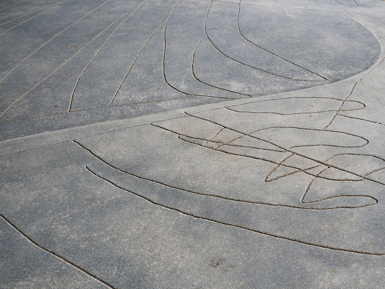
Feathered Changes, 2024
Outdoor permanent floorpiece
Low-relief drawings on concrete surface with balck aggregates
LACMA, Los Angeles, USA
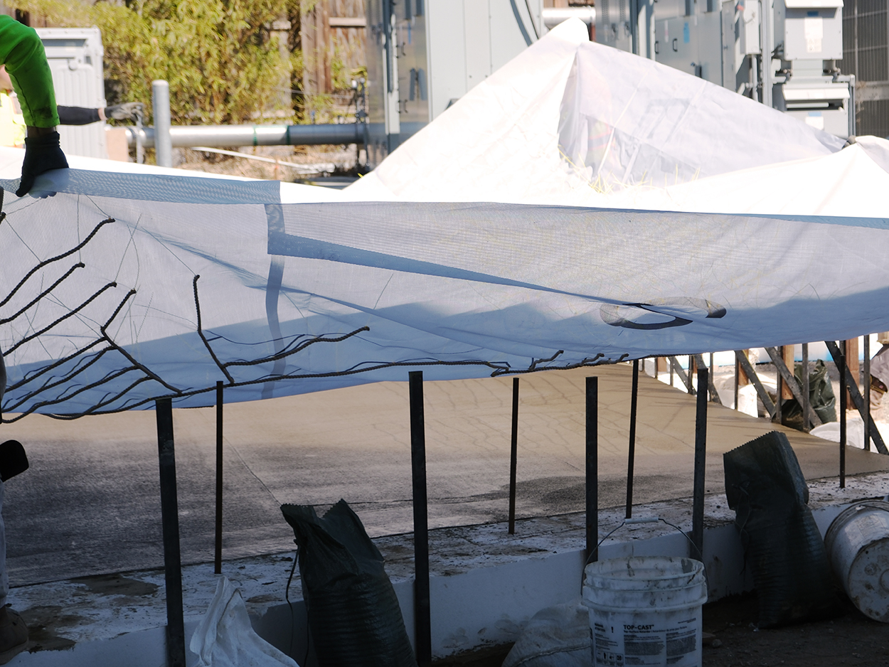
Work in progress of Feathered Changes, 2024
Plastic mesh and rope mould for creating low-relief drawings on concrete surface
LACMA, Los Angeles, USA
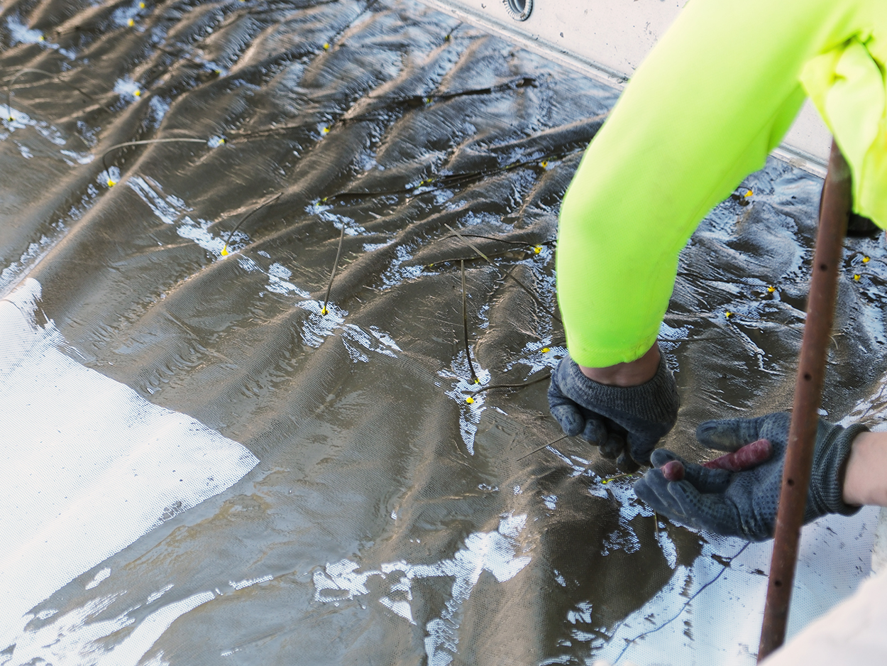
Work in progress of Feathered Changes, 2024
Plastic mesh and rope mould for creating low-relief drawings on concrete surface
LACMA, Los Angeles, USA
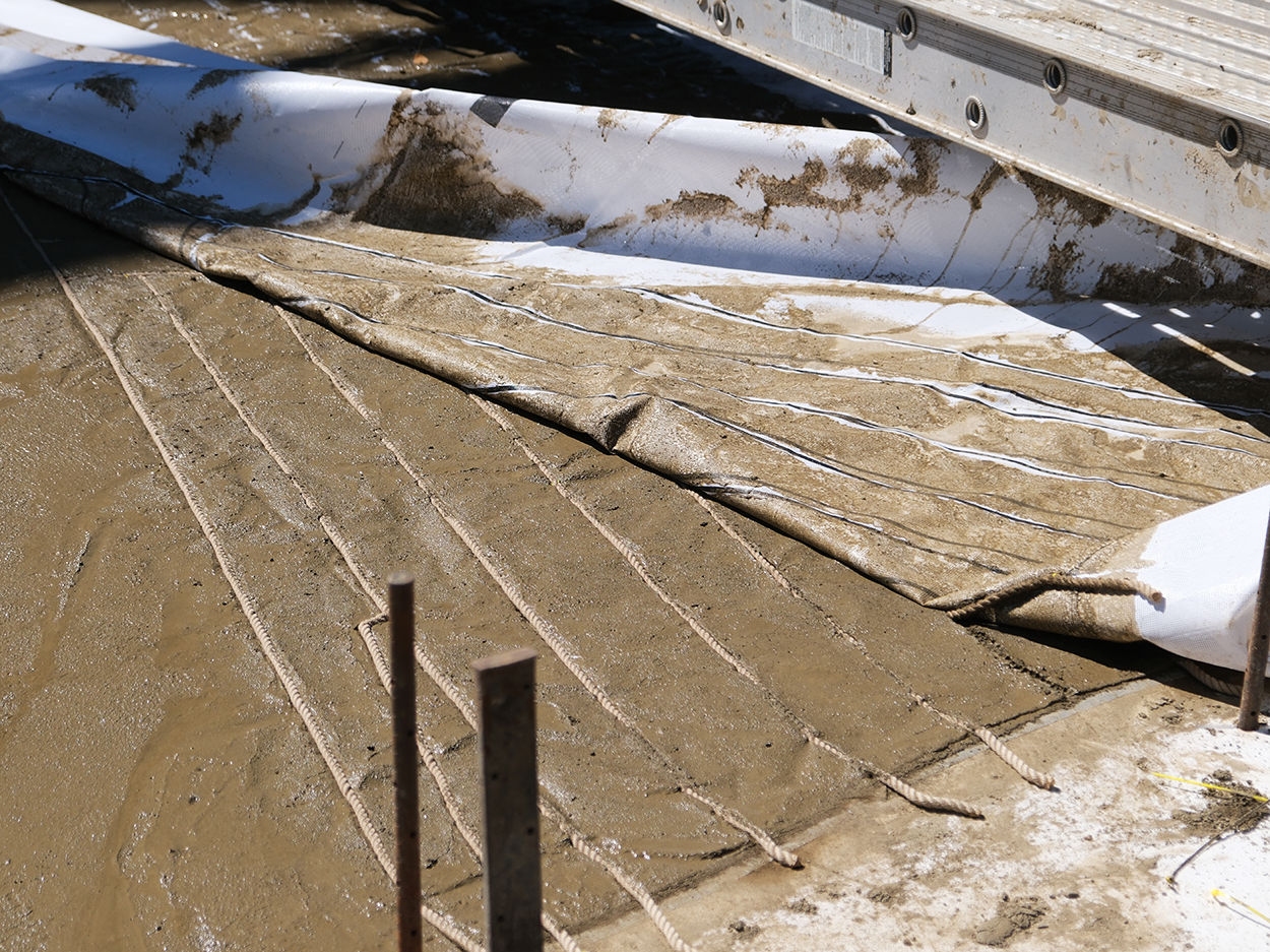
Work in progress of Feathered Changes, 2024
Ropes embedded in a concrete slab to create lowreliefs drawings
LACMA, Los Angeles, USA
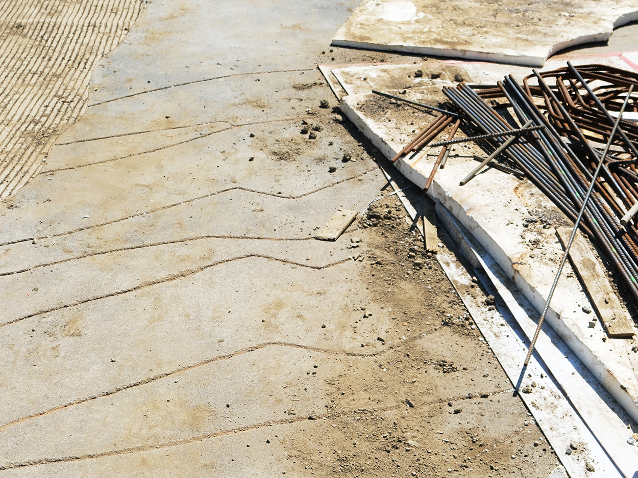
Feathered Changes, 2024
Outdoor permanent floorpiece
Low reliefs drawings embedded in a concrete slab with balck aggregates
LACMA, Los Angeles, USA
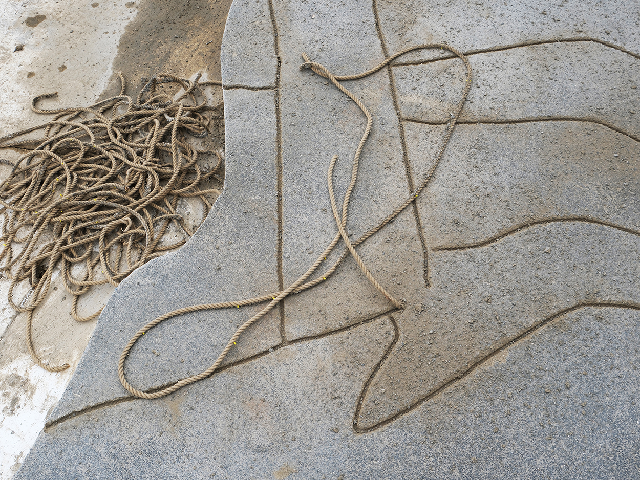
Feathered Changes, 2024
Outdoor permanent floorpiece
Low-relief drawings on concrete surface with balck aggregates
LACMA, Los Angeles, USA
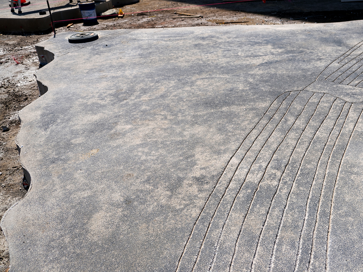
Feathered Changes, 2024
Outdoor permanent floorpiece
Low-relief drawings on concrete surface with balck aggregates
LACMA, Los Angeles, USA
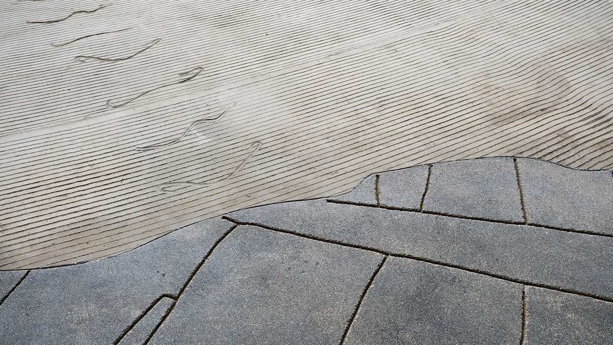
Feathered Changes, 2024
Outdoor permanent floorpiece
Low-relief drawings on concrete surface with balck aggregates
Raked concrete surface with animal paws low-reliefs
LACMA, Los Angeles, USA
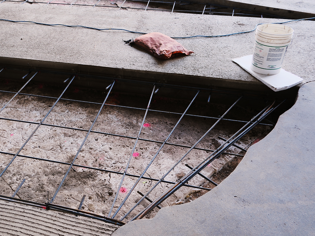
Work in progress of Feathered Changes, 2024
Metal reinforcement for concrete casting
LACMA, Los Angeles, USA
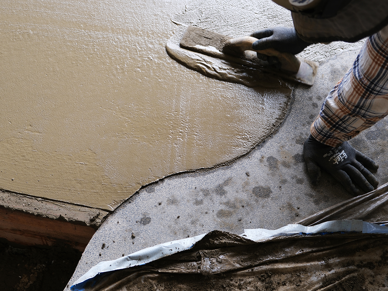
Work in progress of Feathered Changes, 2024
Smoothing phase
LACMA, Los Angeles, USA
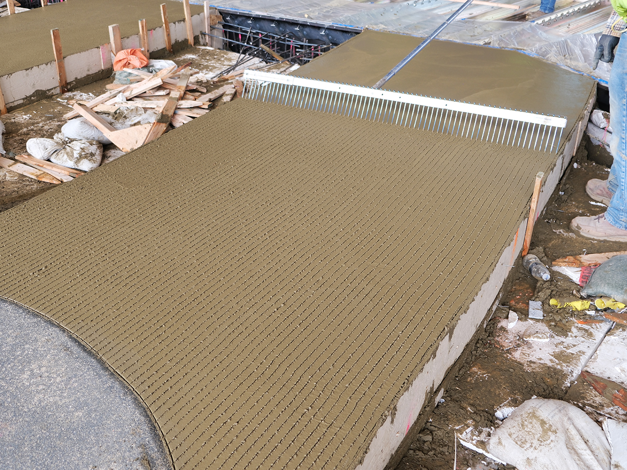
Work in progress of Feathered Changes, 2024
Raking process
LACMA, Los Angeles, USA
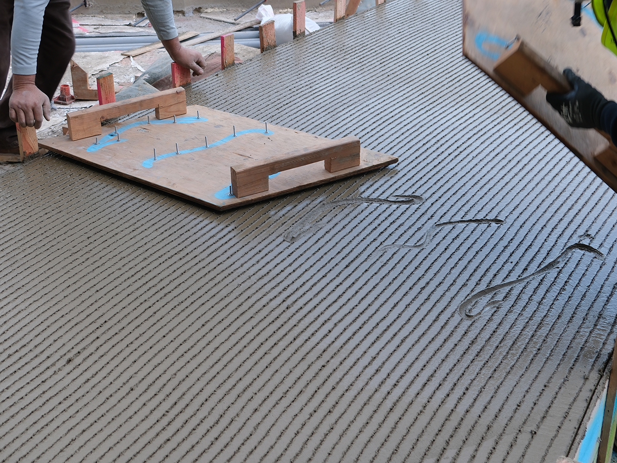
Work in progress of Feathered Changes, 2024
Animal paws low-reliefs
LACMA, Los Angeles, USA
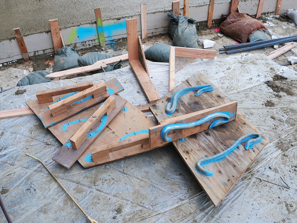
Work in progress of Feathered Changes, 2024
Animal paws molds
LACMA, Los Angeles, USA
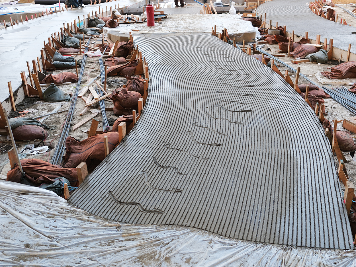
Feathered Changes, 2024
Outdoor permanent floorpiece
Reinforced concrete, raked and low-relief treatment
LACMA, Los Angeles, USA
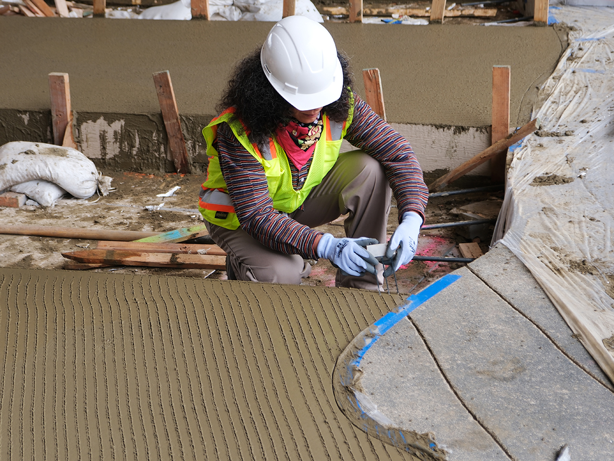
Mariana Castillo Deball
Shot on the building site of Feathered Changes
Raking details
LACMA, Los Angeles, USA
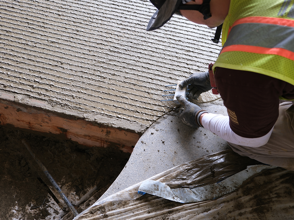
Feathered Changes, 2024
Outdoor permanent floorpiece
Reinforced concrete, raked and low relief treatment
LACMA, Los Angeles, USA
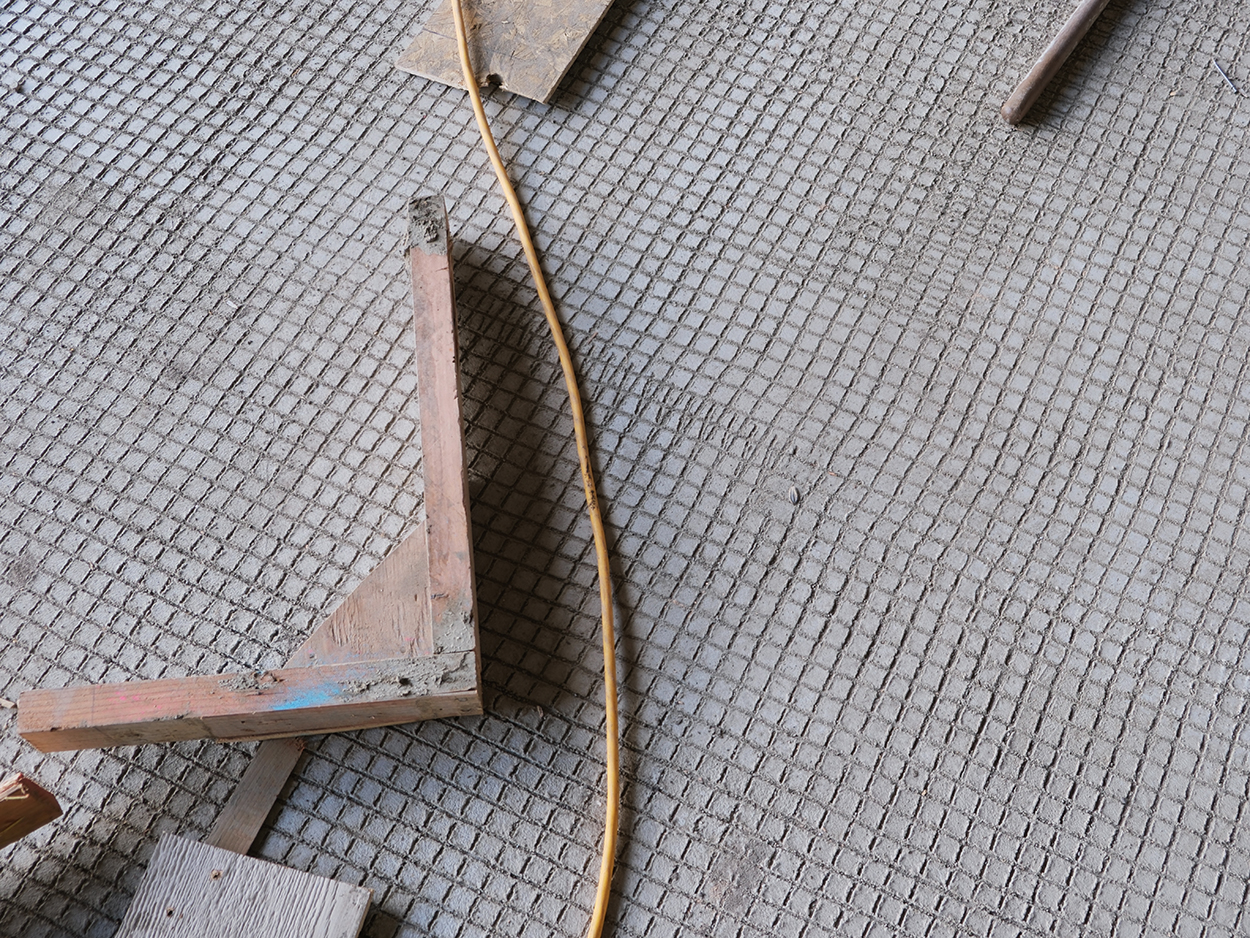
Feathered Changes, 2024
Outdoor permanent floorpiece
Raked concrete surface
LACMA, Los Angeles, USA
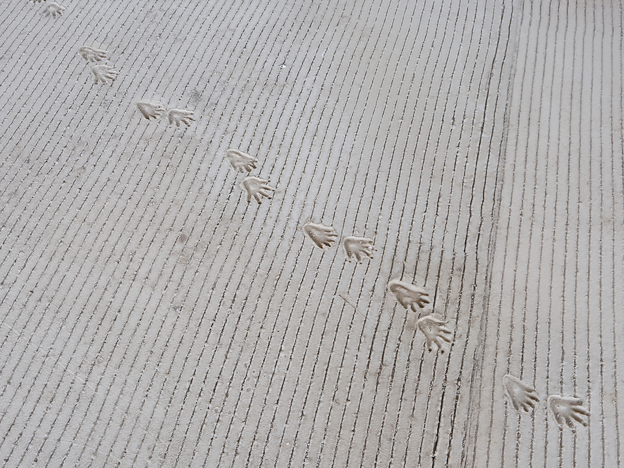
Feathered Changes, 2024
Outdoor permanent floorpiece
Raked concrete surface with animal paws low-reliefs
LACMA, Los Angeles, USA
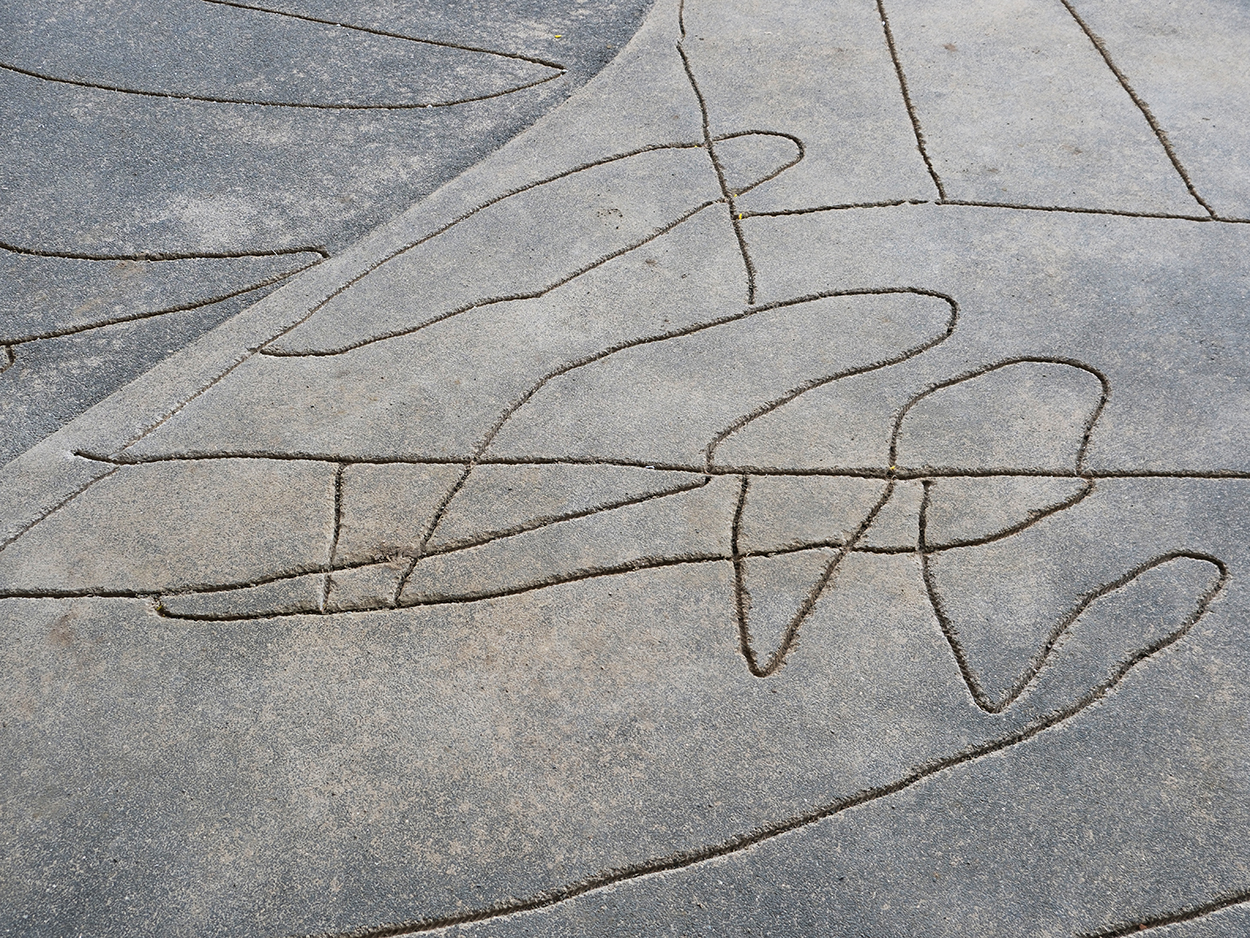
Feathered Changes, 2024
Outdoor permanent floorpiece
Low-relief drawings on concrete surface with balck aggregates
LACMA, Los Angeles, USA
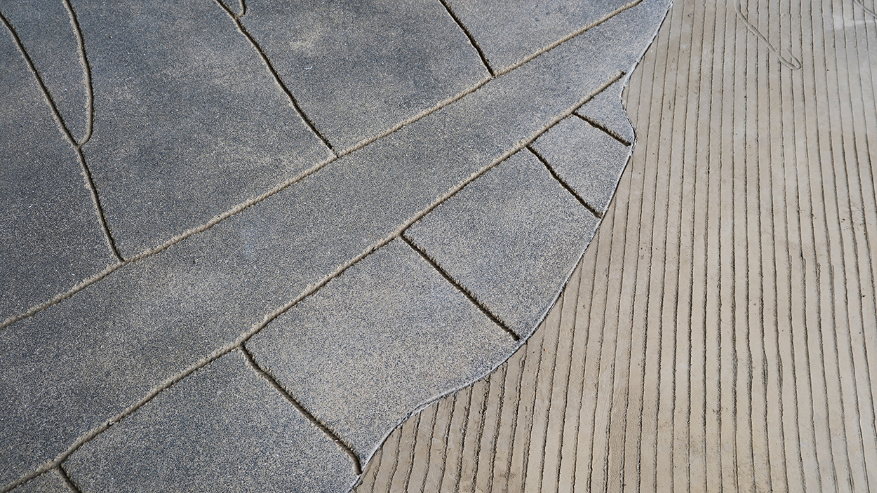
Feathered Changes, 2024
Outdoor permanent floorpiece
Low-relief drawings on concrete surface with balck aggregates
Raked concrete surface with animal paws low reliefs
LACMA, Los Angeles, USA
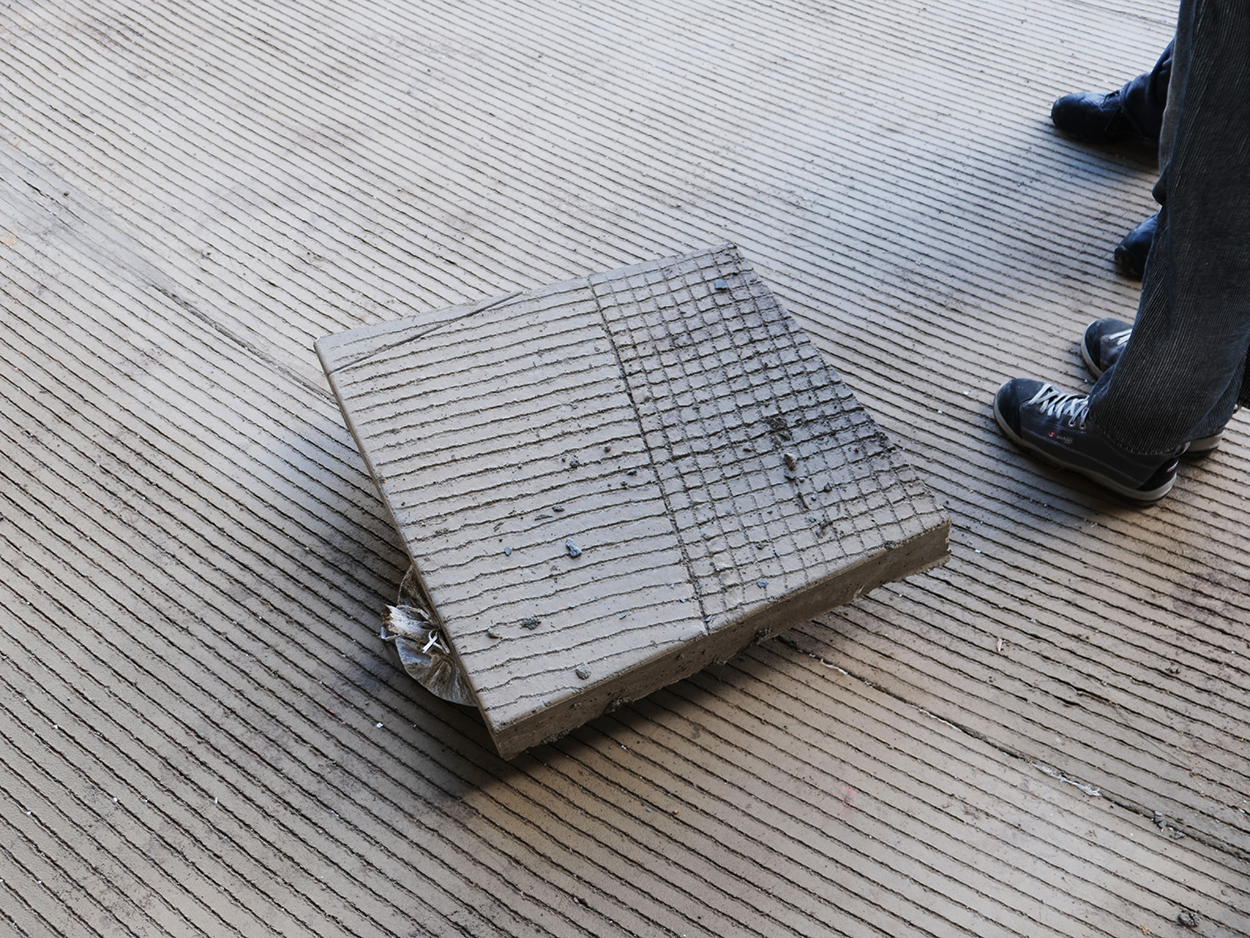
Feathered Changes, 2024
Outdoor permanent floorpiece
Raked concrete surface
LACMA, Los Angeles, USA
Death, I am Still Paper
Organized by Tangente St. Pölten, Austria, August 3 – November 11, 2024
Curators Joana Warza, and Lorena Moreno Vera
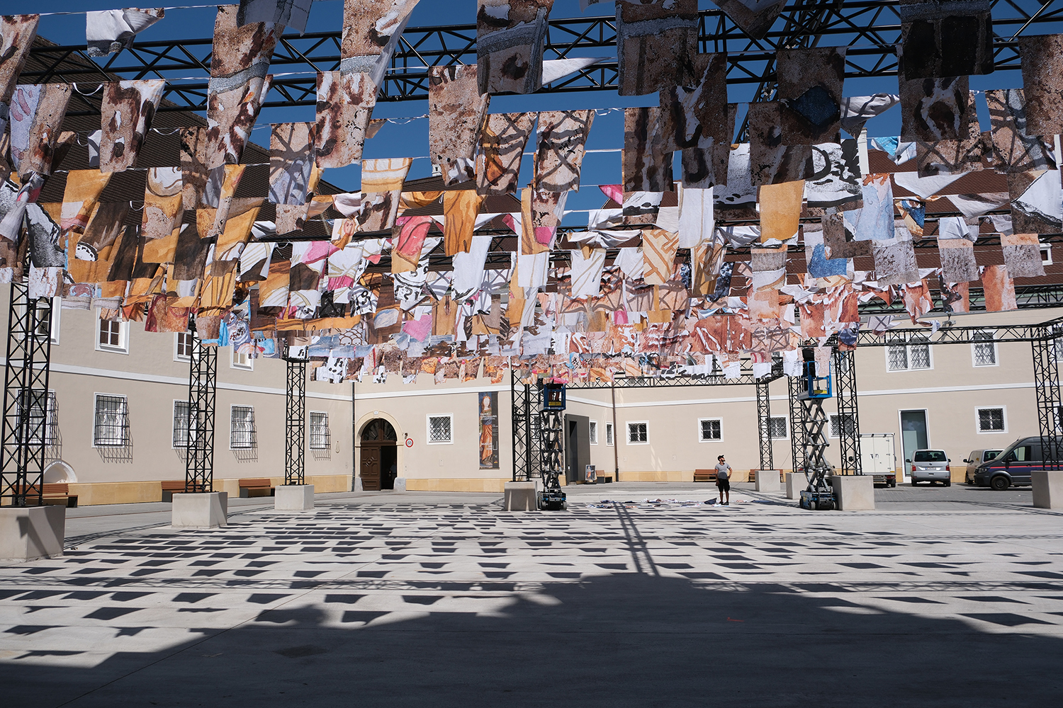
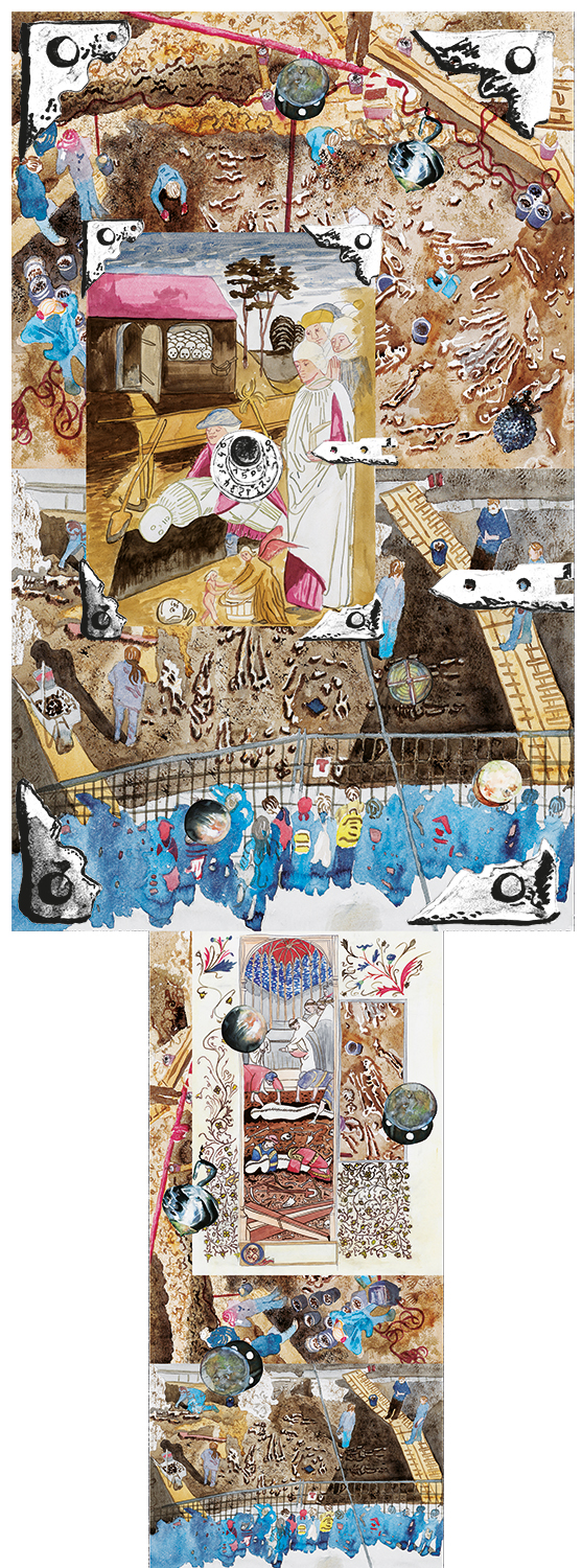
From 2010 to 2019, St. Pölten Cathedral Square was an archaeological
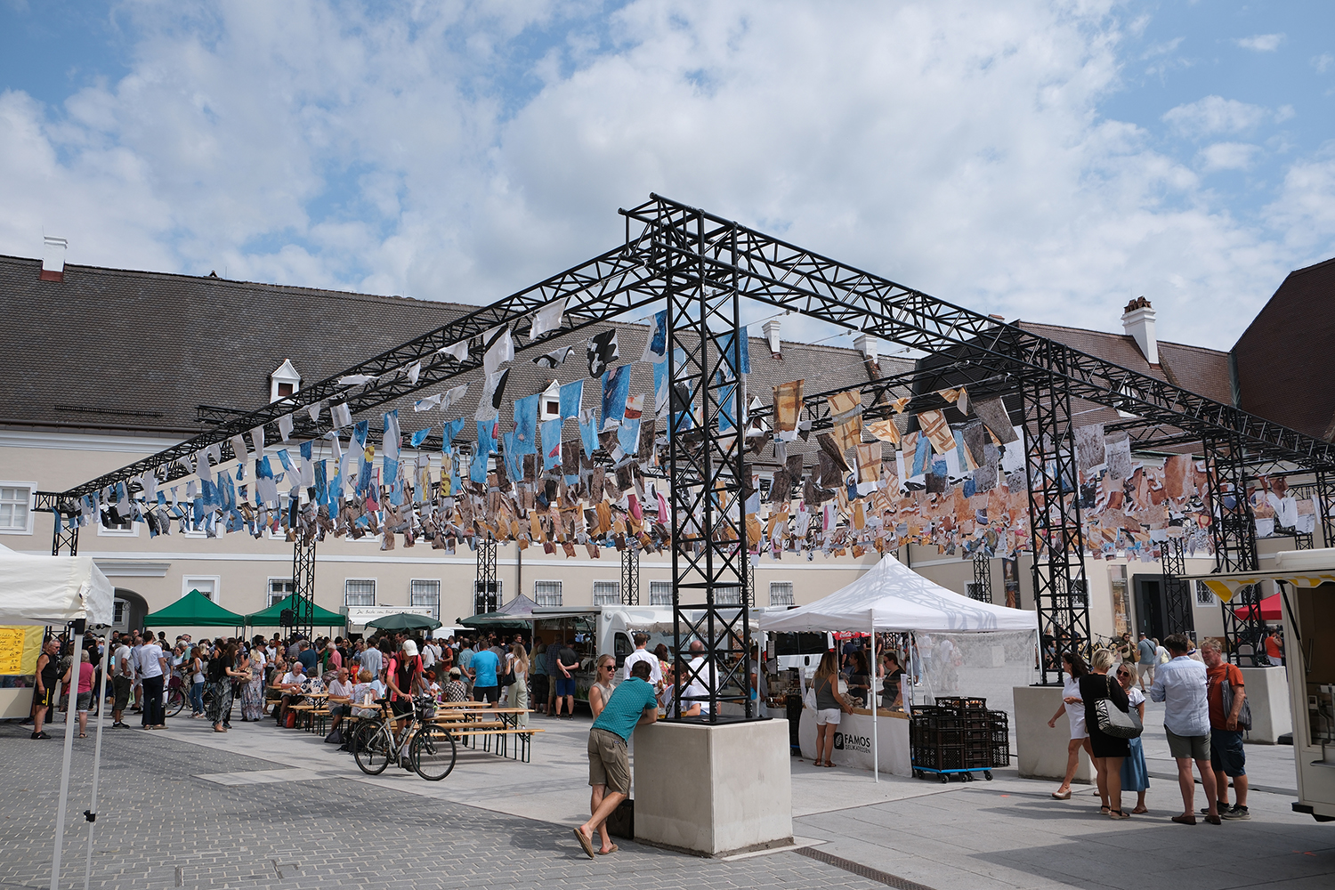
excavation site. During the excavations, not only were Roman and medieval buildings, but also the mortal remains of around 22,000 people were discovered who were buried in a cemetery at this site which was used from the 9th century until 1779. Mariana Castillo Deball's site-specific installation "Dead, I am Still Paper" explores the memory and materiality of the site through the history of paper production. Inspired by objects found among the bodies, the installation reflects on the ephemeral nature of materials such as fabric and paper. Deball links this theme to Goran Petrovic's novel "Paper with Watermarks" („Papir sa vodenim znakom“), which tells of the process of the "democratisation" of paper through the use of rags for its production and the history of the same material as a metaphor for vanity and transformation.
In the 14th century, European workshops began turning old clothes into paper, making it far more accessible than the parchment used previously. Rag collectors played an important role in sourcing materials, even extracting textiles from burial sites, sometimes leading to outbreaks of disease. Deball's work encourages viewers to think about the balance between preservation and decay and the stories that everyday objects tell about our identity and history. "Dead, I am Still Paper" awakens a deeper connection with the past and an awareness of the fragility of memory. And last but not least, it provides welcoming shade in a central location in the city.
Special thanks to curators Joana Warza, and Lorena Moreno Vera; to my studio team Silvia Scandola, David Reiber Otálora, Silvia Andrade and Macarena Cox; to the Tangente installation team, and to publishing house sexto piso, for publishing Papel con sello de Agua and letting me translate some fragments.
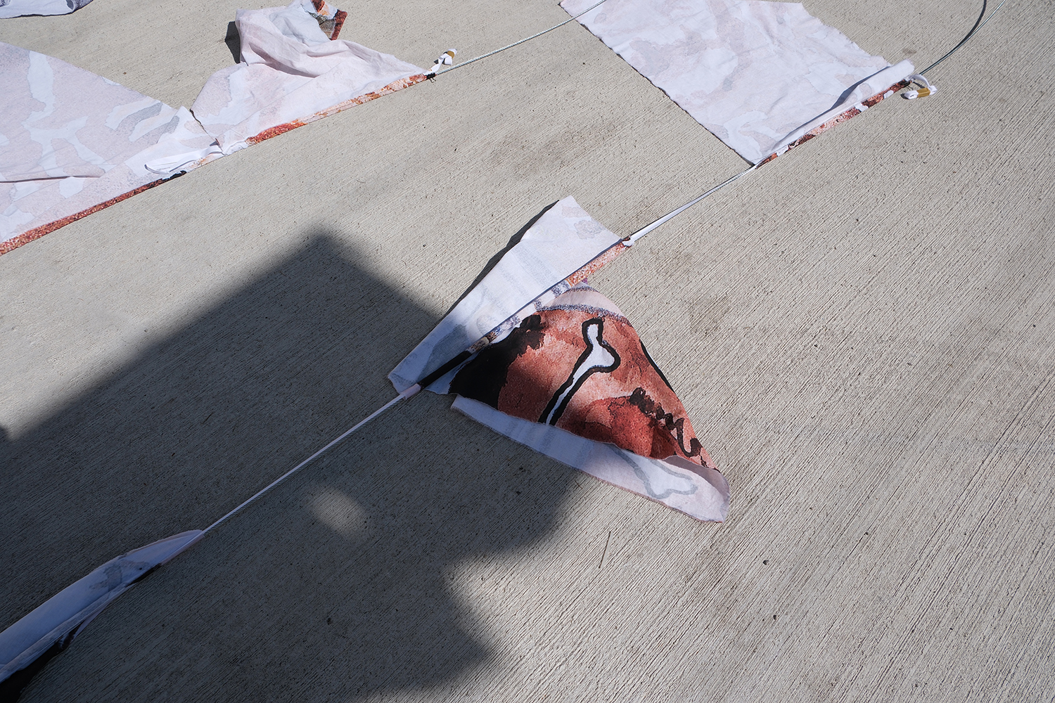
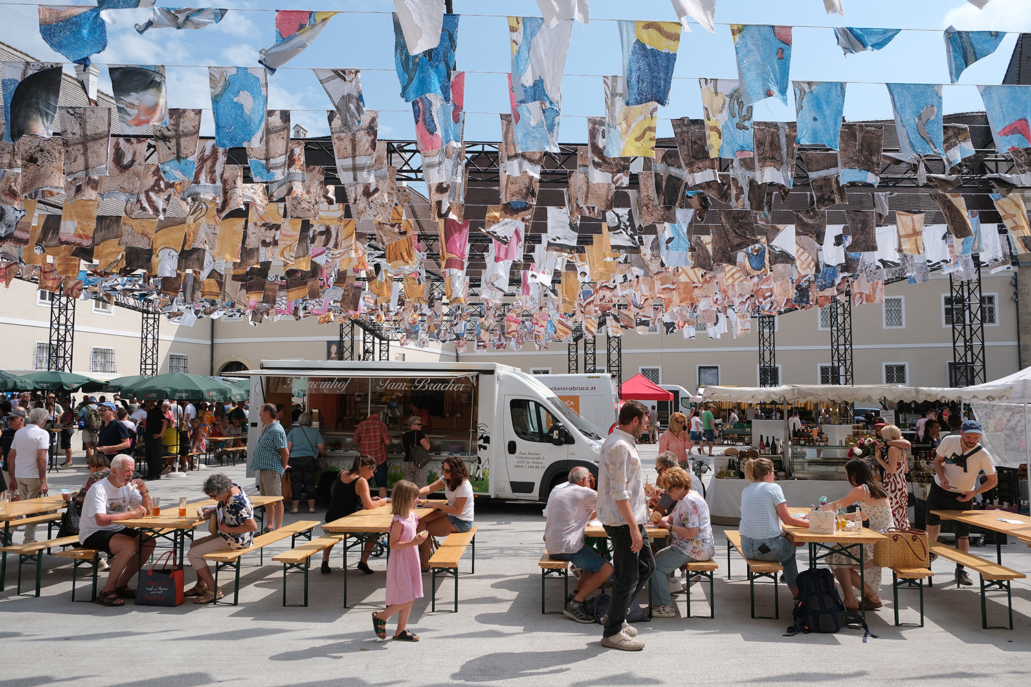
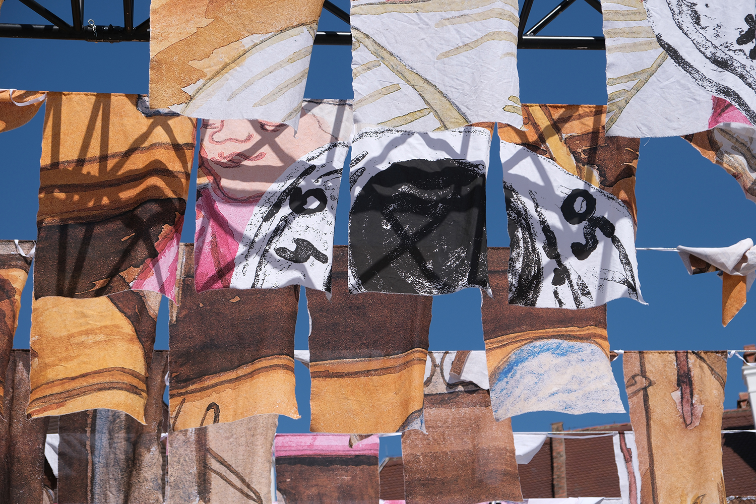
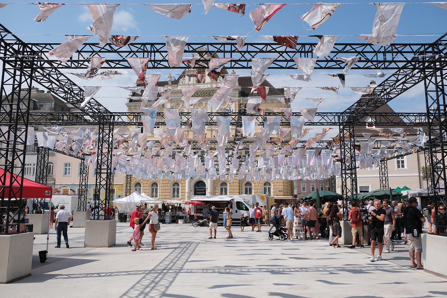
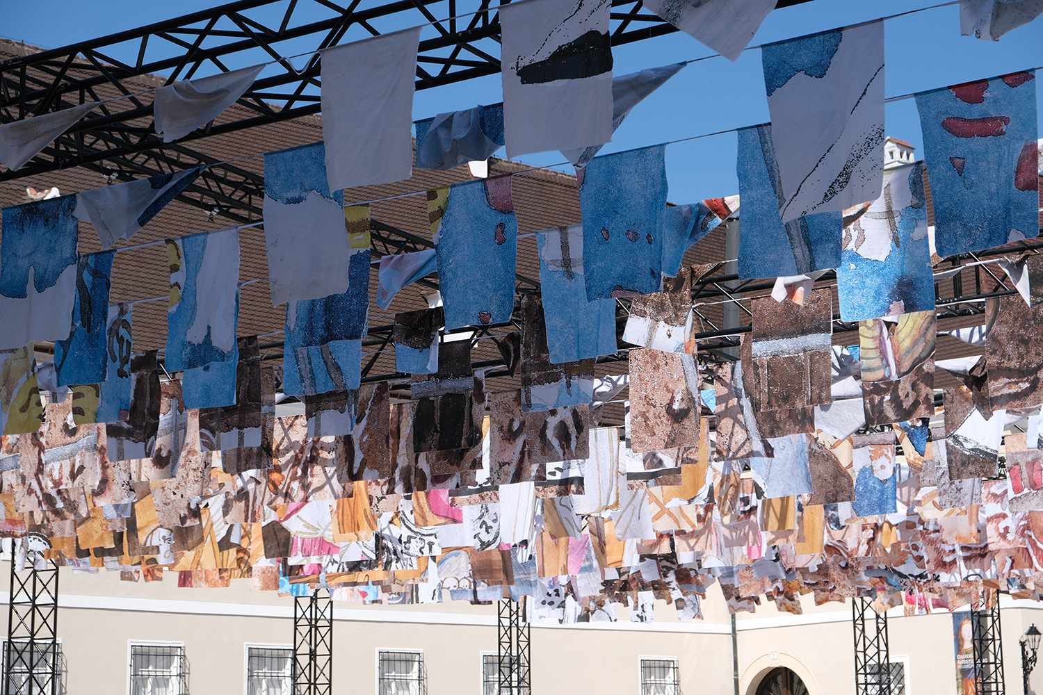
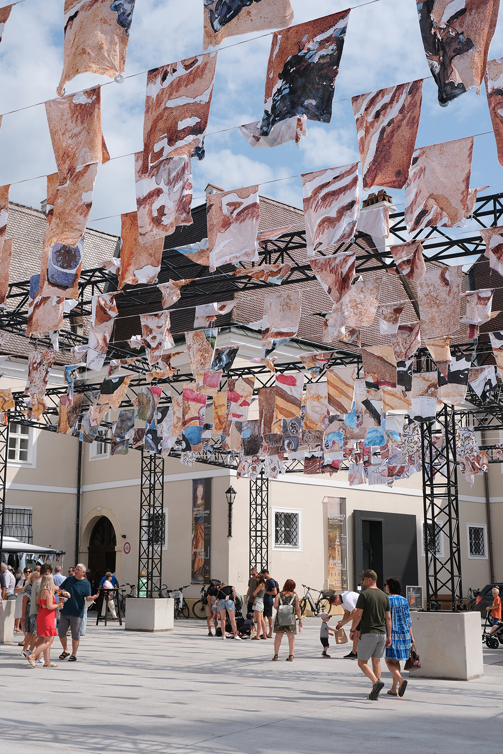
Installation view of “Death, I am Still Paper”
Organized by Tangente St. Pölten, Austria, August 3 – November 11, 2024
Curators Joana Warza, and Lorena Moreno Vera
Photograph courtesy of Studio Castillo Deball © David Reiber Otálora
Firesong for the bees, a tree of clay
Brugge Triennial, Curated by Sevie Tsampalla and Shendy Gardin
13.04 – 01.09.2024
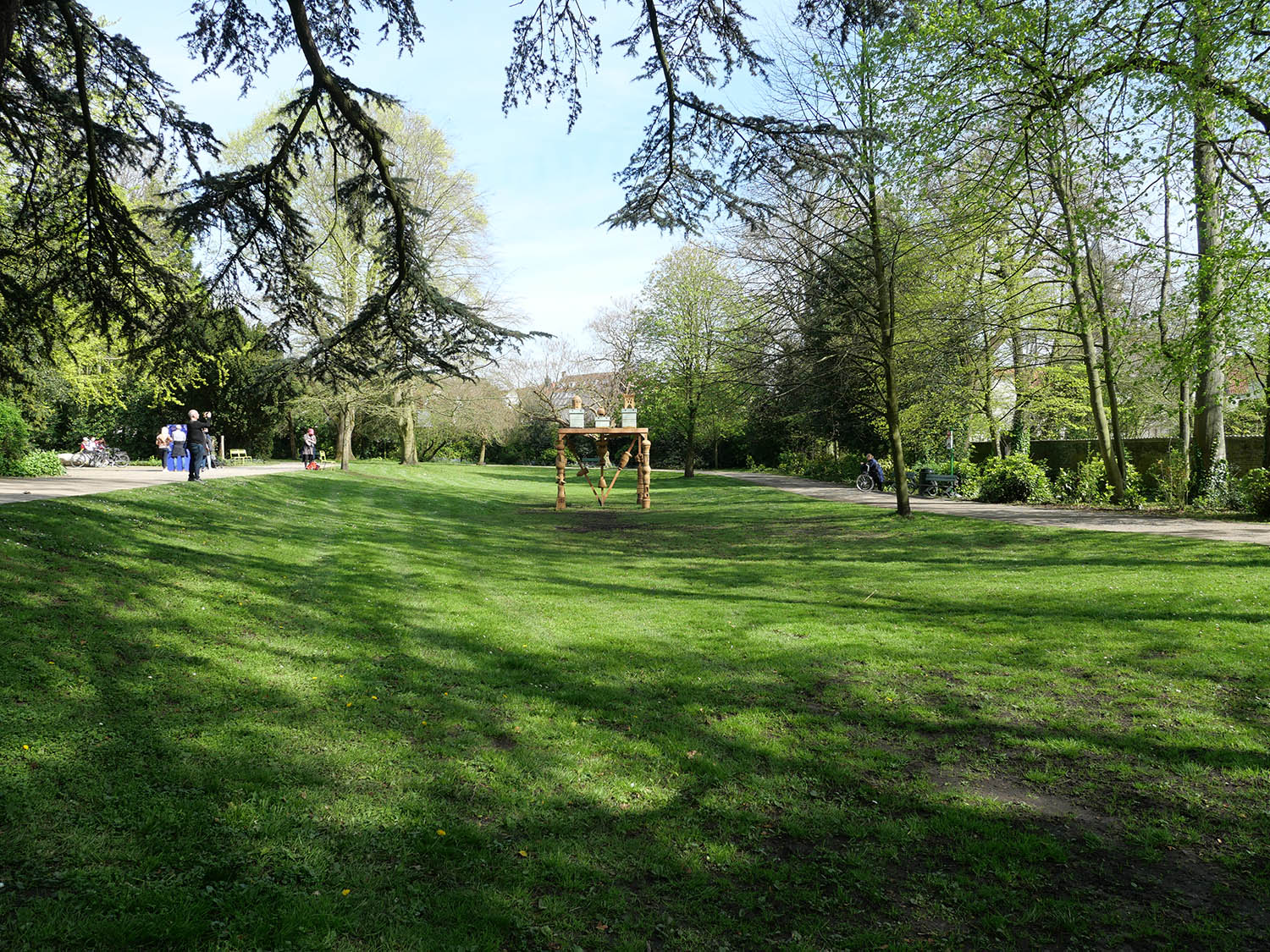
Mariana Castillo Deball has created an architectural, sculptural installation that combines a colony of bees with the history of beehives, located at Professor Dr. J. Sebrechts Park in Brugge.
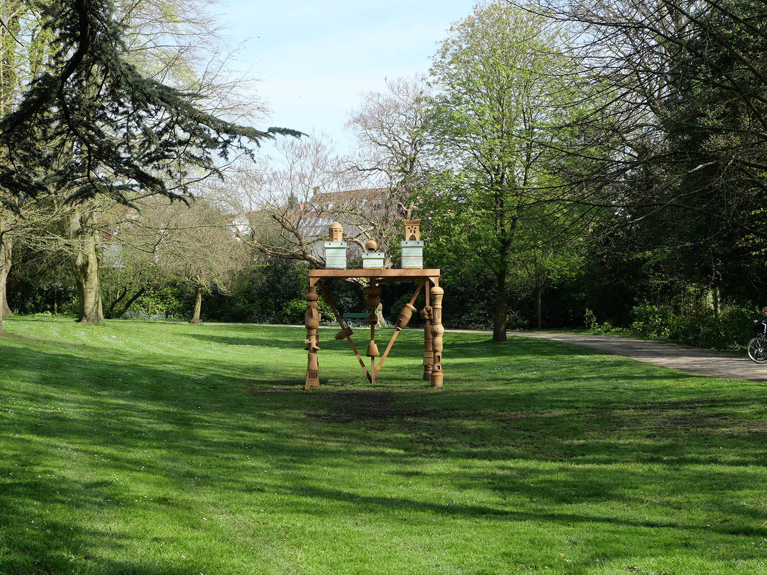
Firesong for the bees, a tree of clay, Sebrechtspark, Trienalle Brugge, Spaces of possibility, Belgium, 2024
Ceramic production Studio Castillo Deball: Silvia Andrade, David Reiber Otálora, Mariana Zarama.
Bee keepers: Biesous/ Margot Hinnekens and Uther Smis
Located in Sebrechtspark, a public park in the historical centre of Bruges, Firesong for the bees, a tree of clay is an architectural-sculptural installation that hosts a beehive. The legs of this playful structure resemble columns made out of several ceramics in various curious shapes, stacked on top of each other. The top wooden platform is home to a colony of bees. Margot and Uther, the two beekeepers entrusted with the care of the bees, come to work on the platform every week.
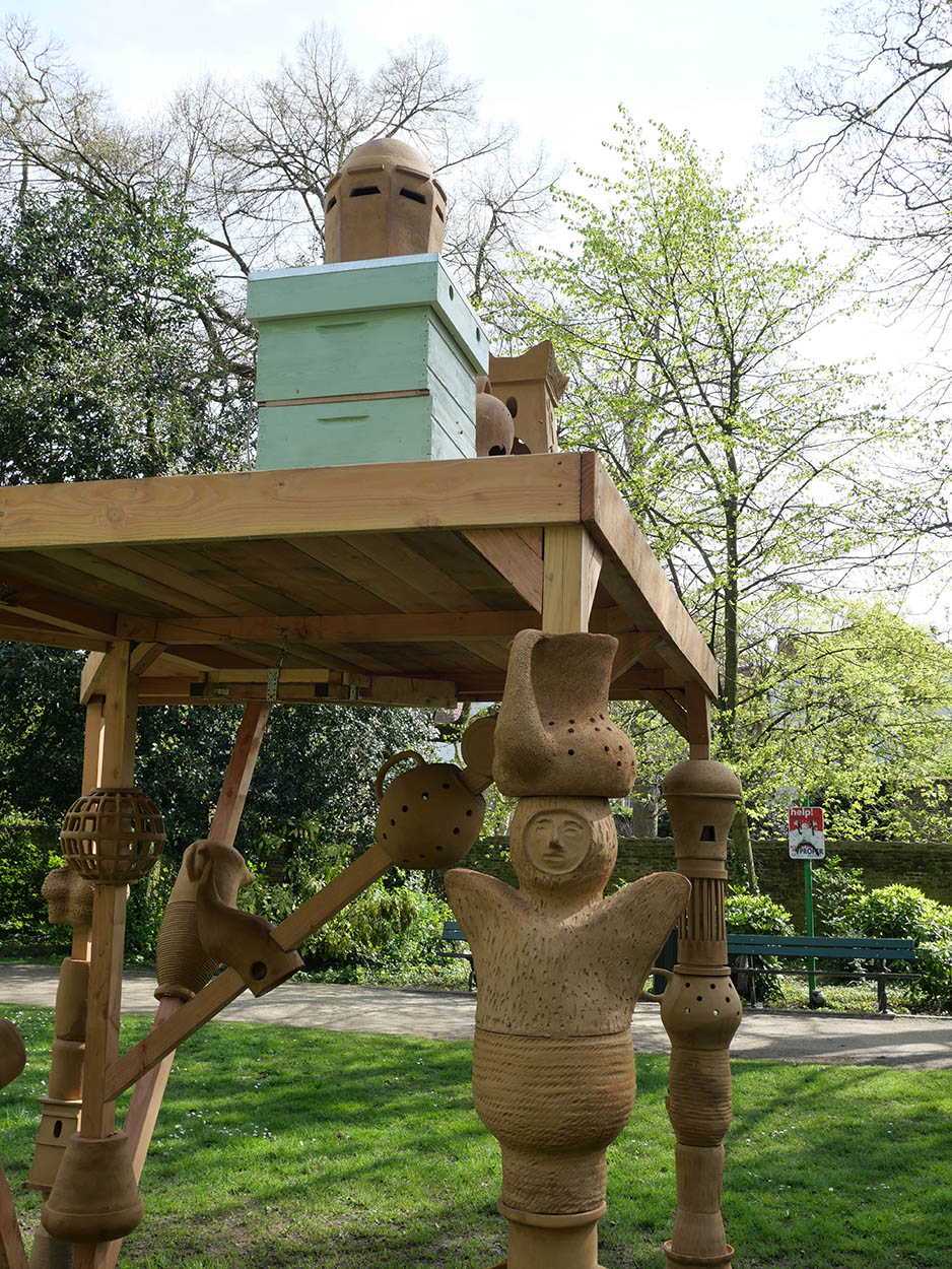
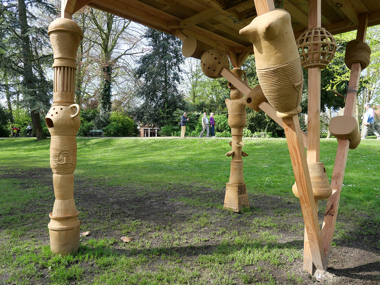
The artwork is informed by the archaeology of beekeeping, that is, the ways in which humans have been relating to bees, developing methods and constructing structures to harvest honey. The ceramics draw on the artist’s research in apiculture traditions before the introduction of the wooden hive. Up until 1852, beehives were diverse in form and materials. Early examples made of straw, clay and fired ceramics were used in Africa, the Mediterranean region and the Middle-East, and are still used today in different parts of the Global South. In Belgium and Northern Europe beehives were usually baskets (skeps) made out of rye straw, sewn with reed, or wood - material that was readily available in the area. Often, they were decorated in idiosyncratic ways that reflected cultural beliefs or their owners personality. The introduction of the standardized wooden beehive meant a halt in this diversity spanning 4.000 years, albeit making honey harvesting easier, as a productive and profitable activity.
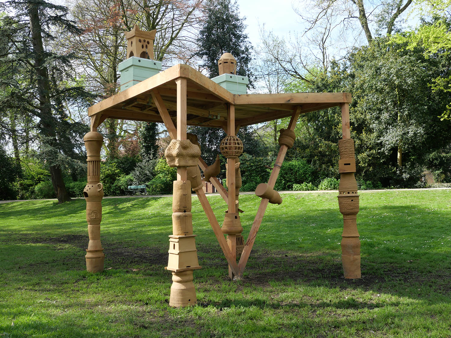

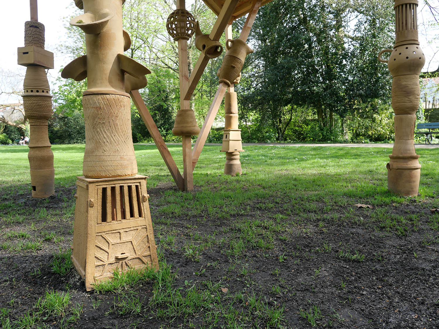

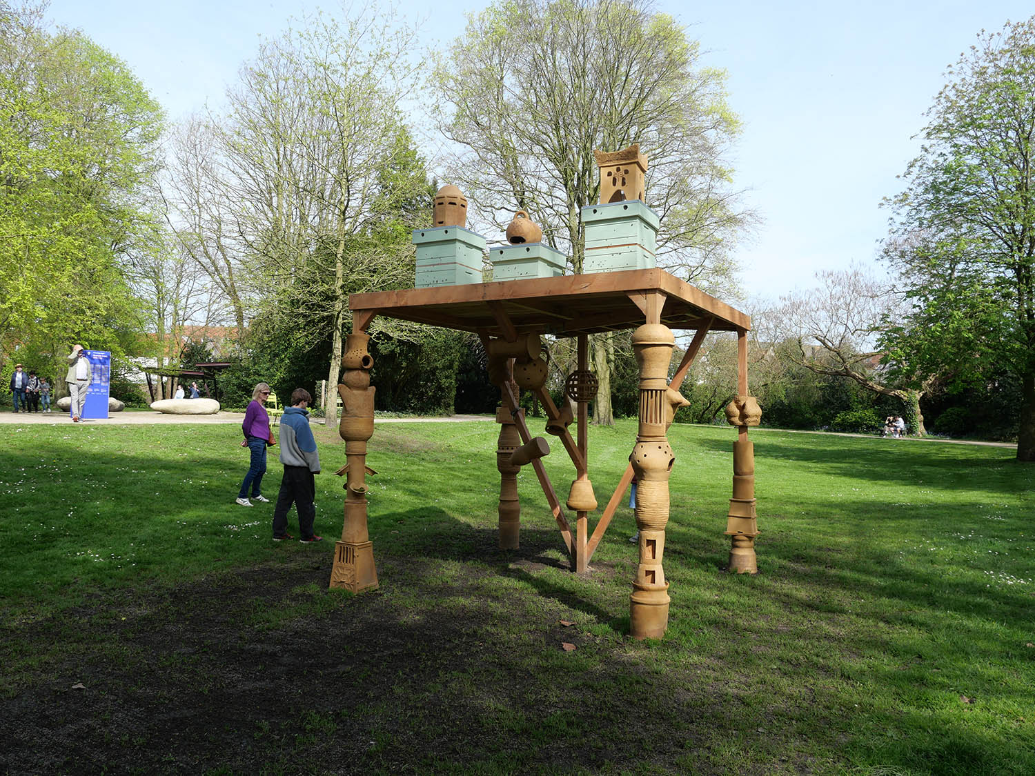
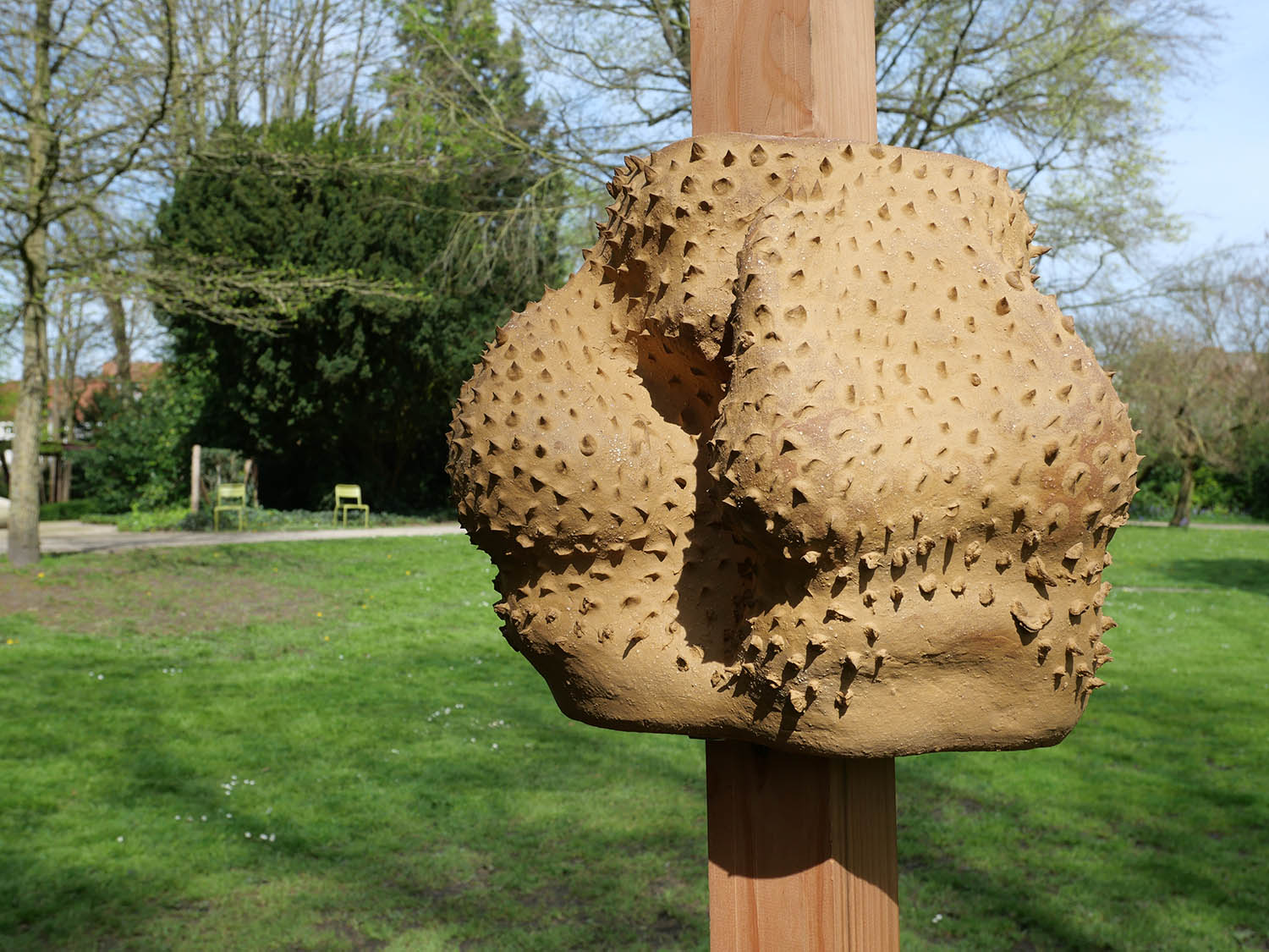
In bringing together a multiplicity of ceramic beehive shapes from various historical and geographical contexts, Firesong for the bees, a tree of clay acts as a kind of ‘repository’ that ‘re-pollinates’ the city with forgotten iconographies, technologies and architectures of apiculture, beyond the dominating modern paradigm. Between a display structure and a critical device, it invites to reflect on the human-non-human interdependencies and labour shaping the human-bees relationship to this day. Bees are the most important pollinators in the eco-system, but the ecological crisis is causing a significant decline in bee populations world-wide. The work asks us to think not only about artefacts becoming obsolete, but also about the extractive human-led processes that lead to species extinction. It is an invitation to sense and learn from the noises, smells and histories of the collective more-than-human intelligences that make the work.
In the bee-friendly city of Bruges, the artist collaborates with Biesous/ Margot Hinnekens and Uther Smis, an initiative of young bee keepers from the region, who care for the bees during the five months of Spaces of Possibility. The project is done with respect to the bees' wellbeing and the biodiversity in the park and the city. They will continue to take care of the bees after the end of the Triennial, when the artwork will be dismantled. Some of the elements of the structure will be donated to the apicultural circuit in Bruges, continuing their lives in the region.
Text: Sevie Tsampalla
Digital design for the Purple (D Line) Extension as part of the future Wilshire / LA Cienega Station
Commissioned by LACMTA (Metro)
This artwork for future Wilshire/La Cienega Station is comprised of four landscape images integrated into two collages that run along the north and south walls of the station concourse. The base of the collage are paper cut outlines from historical maps of the Pacific Coast and the American Continent. Each layer represents a specific geographic location and was created utilizing a unique technique.
The final creation weaves together four landscape images: Fossil Ground, ink rubbings made from fossils excavated at the construction site of the station as well as other fossils from the same period; Woven Cienega, a plaster interpretation of the historic Rancho La Cienega topography with an imprint of a basket pattern similar to weaving techniques created by Indigenous persons of the region; Urban Desert Fauna, an abstraction of the river transformed into an urban path that runs through the vista and includes drawings of animal species native to the region; and Medicinal Flora, ink drawings of indigenous medicinal plants.
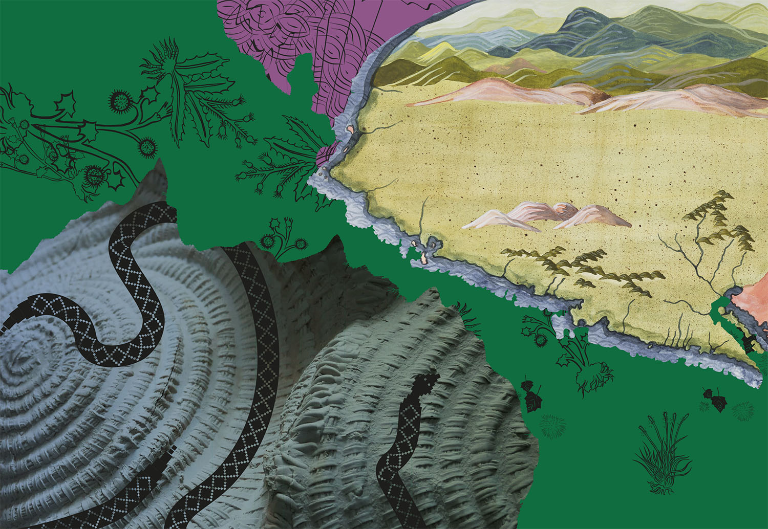
Detail of Four Pleated Landscapes: Fossil Ground, Woven Cienega, Medicinal Flora and Urban Dessert Fauna, digital design for the North Wall
Distribution of Wealth Chart versus Geological Strata
permanent Site-specific artwork at Zürich Insurance group, Zürich, Switzerland, 2021.
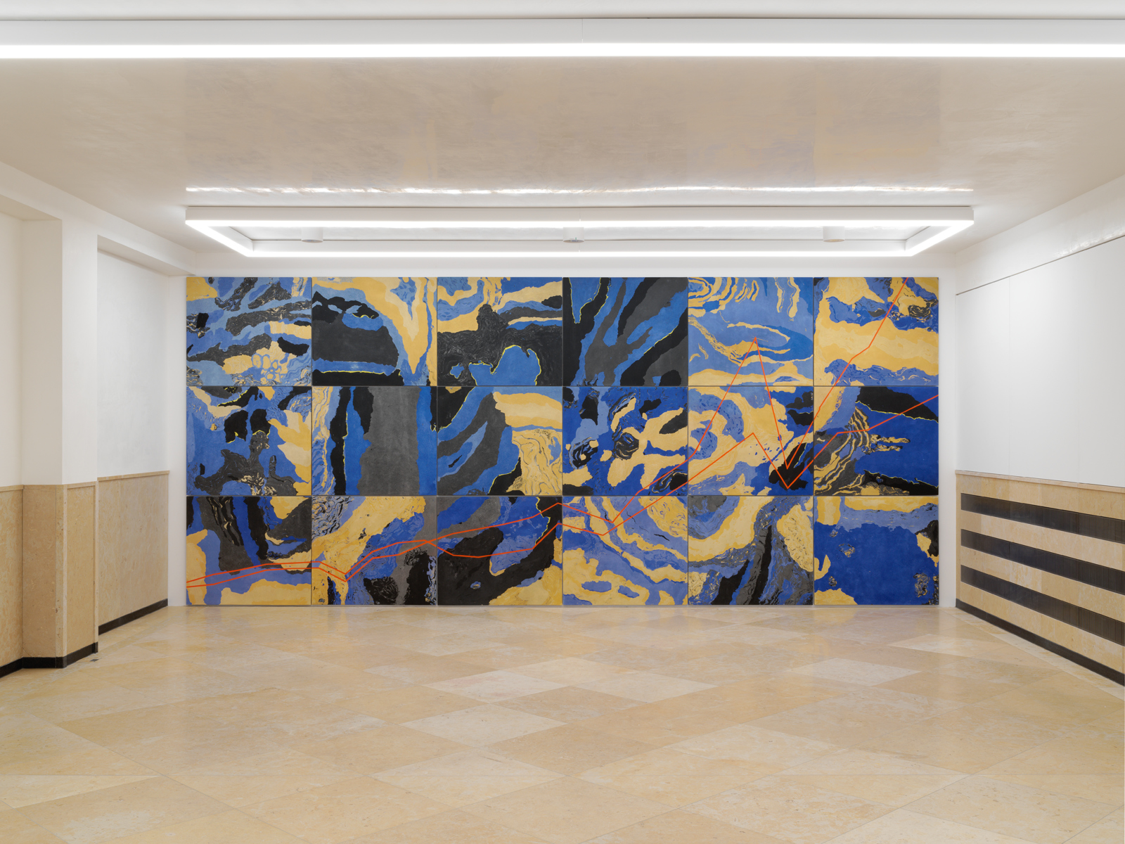
Distribution of Wealth Chart versus Geological Strata 2021,
Stuckmarmor on 18 aluminium,
Panels, 661 x 285 x 2,7 cm .
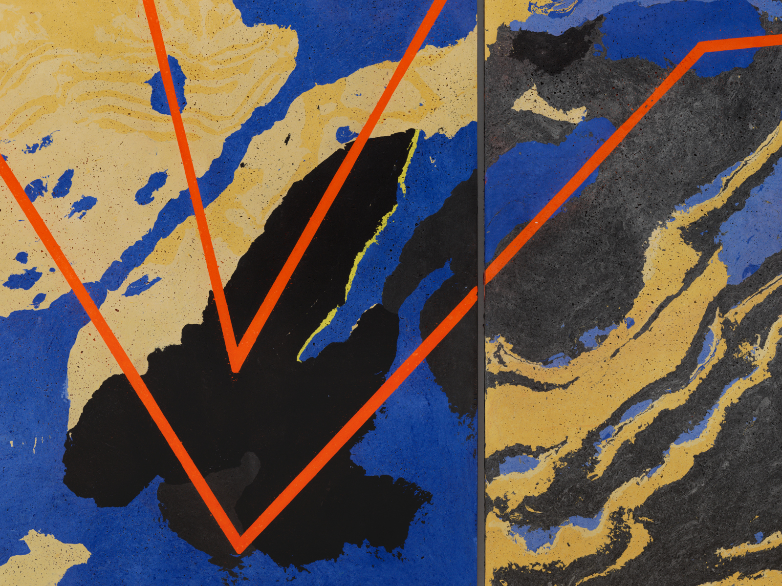
Detail of Distribution of Wealth Chart versus Geological Strata 2021,
Stuckmarmor on 18 aluminium,
Panels, 661 x 28 5 x 2,7 cm.
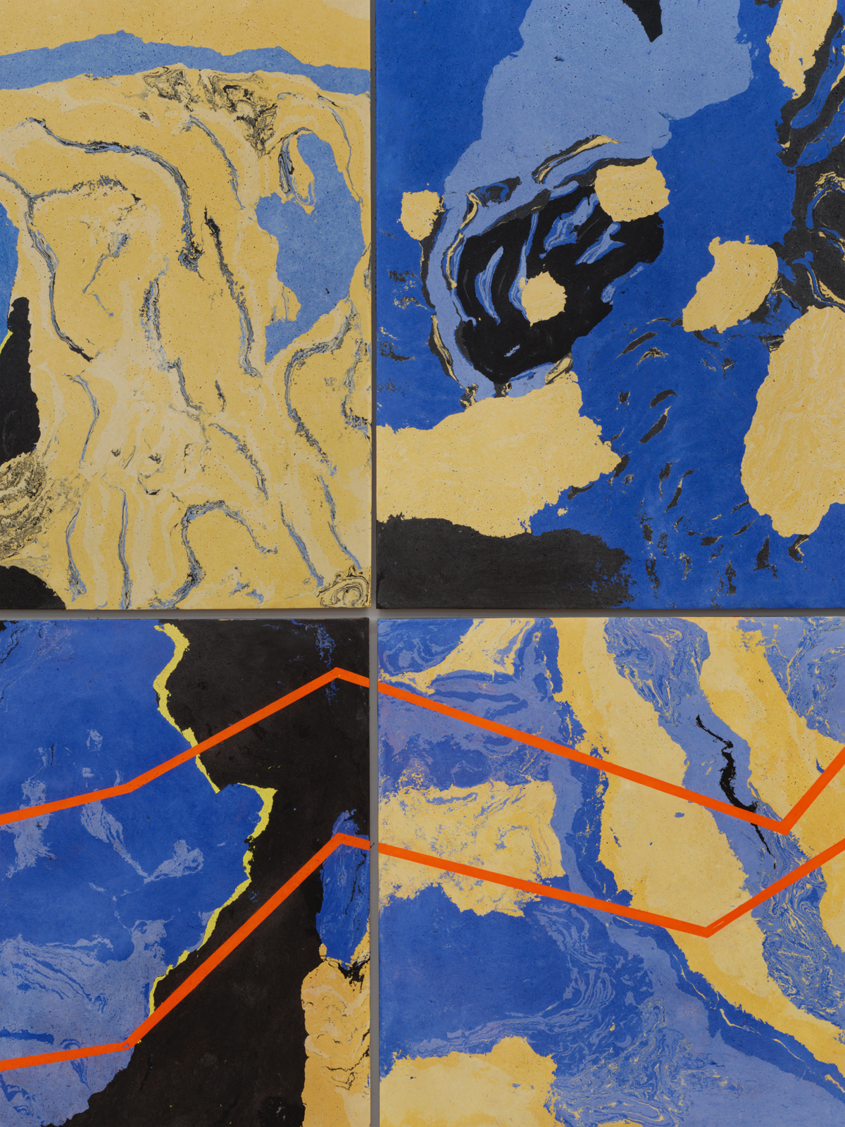
Detail of Distribution of Wealth Chart versus Geological Strata 2021,
Stuckmarmor on 18 aluminium,
Panels, 661 x 28 5 x 2,7 cm.
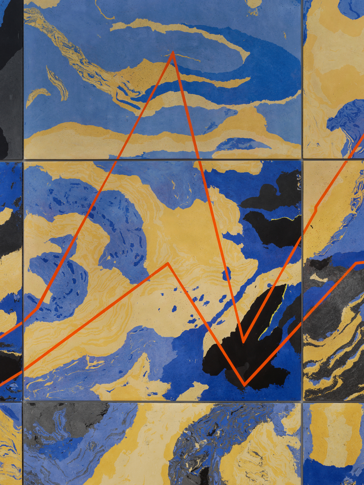
Detail of Distribution of Wealth Chart versus Geological Strata 2021,
Stuckmarmor on 18 aluminium,
Panels, 661 x 28 5 x 2,7 cm.
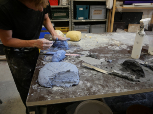
Work in progress of Distribution of Wealth Chart versus Geological Strata 2021,
Stuckmarmor on 18 aluminium,
Panels, 661 x 28 5 x 2,7 cm.
Work in progress of Distribution of Wealth Chart versus Geological Strata 2021,
Stuckmarmor on 18 aluminium,
Panels, 661 x 28 5 x 2,7 cm.
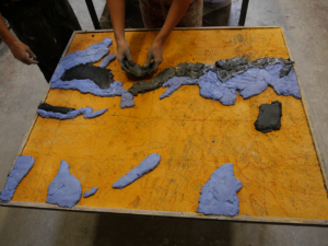
Work in progress of Distribution of Wealth Chart versus Geological Strata 2021,
Stuckmarmor on 18 aluminium,
Panels, 661 x 28 5 x 2,7 cm.
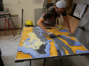
Work in progress of Distribution of Wealth Chart versus Geological Strata 2021,
Stuckmarmor on 18 aluminium,
Panels, 661 x 28 5 x 2,7 cm.
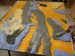
Work in progress of Distribution of Wealth Chart versus Geological Strata 2021,
Stuckmarmor on 18 aluminium,
Panels, 661 x 28 5 x 2,7 cm.
Walking through the town I followed a pattern on the pavement that became the magnified silhouette of a woman's profile
England's Creative Coast's Waterfronts project with Towner Eastbourne curated by Tamsin Dillon
May 29 – November 12, 2021

printed map on the occasion of the public artwork Walking through the town i followed a pattern on the pavement that became the magnified silhouette of a woman´s profile
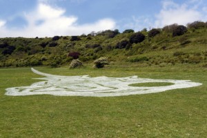
Inspired by local archaeological sites, artist Mariana Castillo Deball has created a public artwork that plays out across the streets of Eastbourne, into Towner Eastbourne's gallery building and out to the South Downs. Walking through the town I followed a pattern on the pavement that became the magnified silhouette of a woman's profile is, explains Castillo Deball, "a work that can be experienced as an image, a walking path or a narrative". On this two-hour walking route around the streets of Eastbourne, pedestrians will discover a chalk-stenciled rope that traces an unexpected route through the town, outlining the silhouette of a woman's profile. Followers of the walking trail will encounter several sculptural objects embedded in the pavement, each relating to objects that were buried with The Frankish Woman, whose ancient remains were discovered in Eastbourne at the Anglo-Saxon cemetery on St Anne's Hill. The locations for the objects are shown on the map as a loop in the rope. A third element to the work takes place at Whitbread Hollow on the South Downs where the shape of a giant hairpin, the most magnificent of the funerary objects, will be inscribed in chalk. In contrast to the nearby Celtic hill figure, The Long Mari of Wilmington which is cut into the chalk a few miles north-east of Eastbourne, Castillo Deball's geoglyph will be evanescent, disappearing over time. Visit towner.gallery/CreativeCoast for more details on this work and how to see it. Alongside her Waterfronts commission, Castillo Deball has curated an exhibition for Towner Eastbourne. A drawing, a story and a poem go for a Walk will run from 29 May 2021 to 16 January 2022.
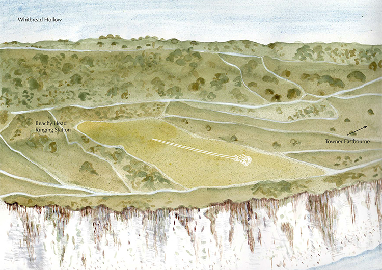
printed map on the occasion of the public artwork Walking through the town i followed a pattern on the pavement that became the magnified silhouette of a woman´s profile
Beachy Head, Head pin geoglyph location. 2021
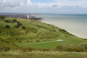
Walking through the town i followed a pattern on the pavement that became the magnified silhouette of a woman´s profile, Waterfronts, Creative Coast Project, Eastbourne, England, 2021. Photo Thierry Bal
Installation view of the public artwork Walking through the town i followed a pattern on the pavement that became the magnified silhouette of a woman´s profile, Waterworks, Creative Coast Project, Eastbourne, England, 2021.
Photo © Thierry Bal
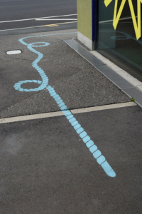
Installation view of the public artwork Walking through the town i followed a pattern on the pavement that became the magnified silhouette of a woman´s profile, Waterworks, Creative Coast Project, Eastbourne, England, 2021.
Photo © Thierry Bal
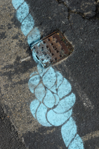
detail of the public artwork Walking through the town i followed a pattern on the pavement that became the magnified silhouette of a woman´s profile, Waterworks, Creative Coast Project, Eastbourne, England, 2021.
Photo © Thierry Bal
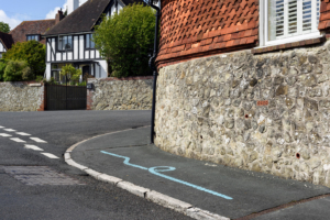
Installation view of the public artwork Walking through the town i followed a pattern on the pavement that became the magnified silhouette of a woman´s profile, Waterworks, Creative Coast Project, Eastbourne, England, 2021.
Photo © Thierry Bal
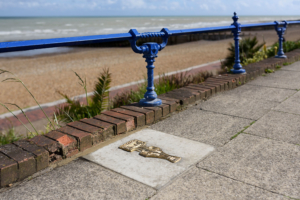
Installation view of the public artwork Walking through the town i followed a pattern on the pavement that became the magnified silhouette of a woman´s profile, Waterworks, Creative Coast Project, Eastbourne, England, 2021.
Photo © Thierry Bal
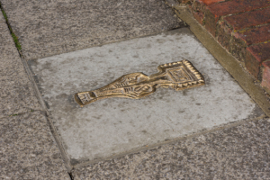
Installation view of the public artwork Walking through the town i followed a pattern on the pavement that became the magnified silhouette of a woman´s profile, Waterworks, Creative Coast Project, Eastbourne, England, 2021.
Photo © Thierry Bal
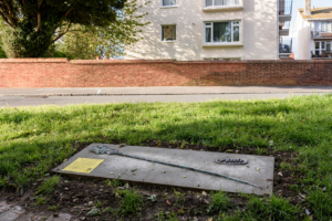
Installation view of the public artwork Walking through the town i followed a pattern on the pavement that became the magnified silhouette of a woman´s profile, Waterworks, Creative Coast Project, Eastbourne, England, 2021.
Photo © Thierry Bal
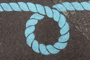
detail of the public artwork Walking through the town i followed a pattern on the pavement that became the magnified silhouette of a woman´s profile, Waterworks, Creative Coast Project, Eastbourne, England, 2021.
Photo © Thierry Bal
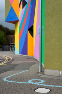
Installation view of the public artwork Walking through the town i followed a pattern on the pavement that became the magnified silhouette of a woman´s profile, Waterworks, Creative Coast Project, Eastbourne, England, 2021.
Photo © Thierry Bal
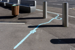
Installation view of the public artwork Walking through the town i followed a pattern on the pavement that became the magnified silhouette of a woman´s profile, Waterworks, Creative Coast Project, Eastbourne, England, 2021.
Photo © Thierry Bal
A DRAWING, A STORY AND A POEM GO FOR A WALK: MARIANA CASTILLO DEBALL CURATES THE TOWNER COLLECTION
May 29 2021 – January 16 2022
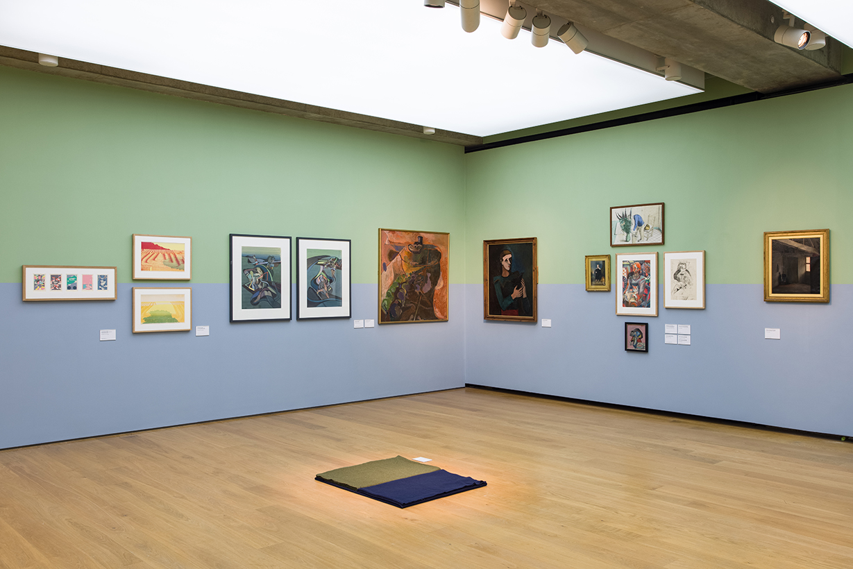
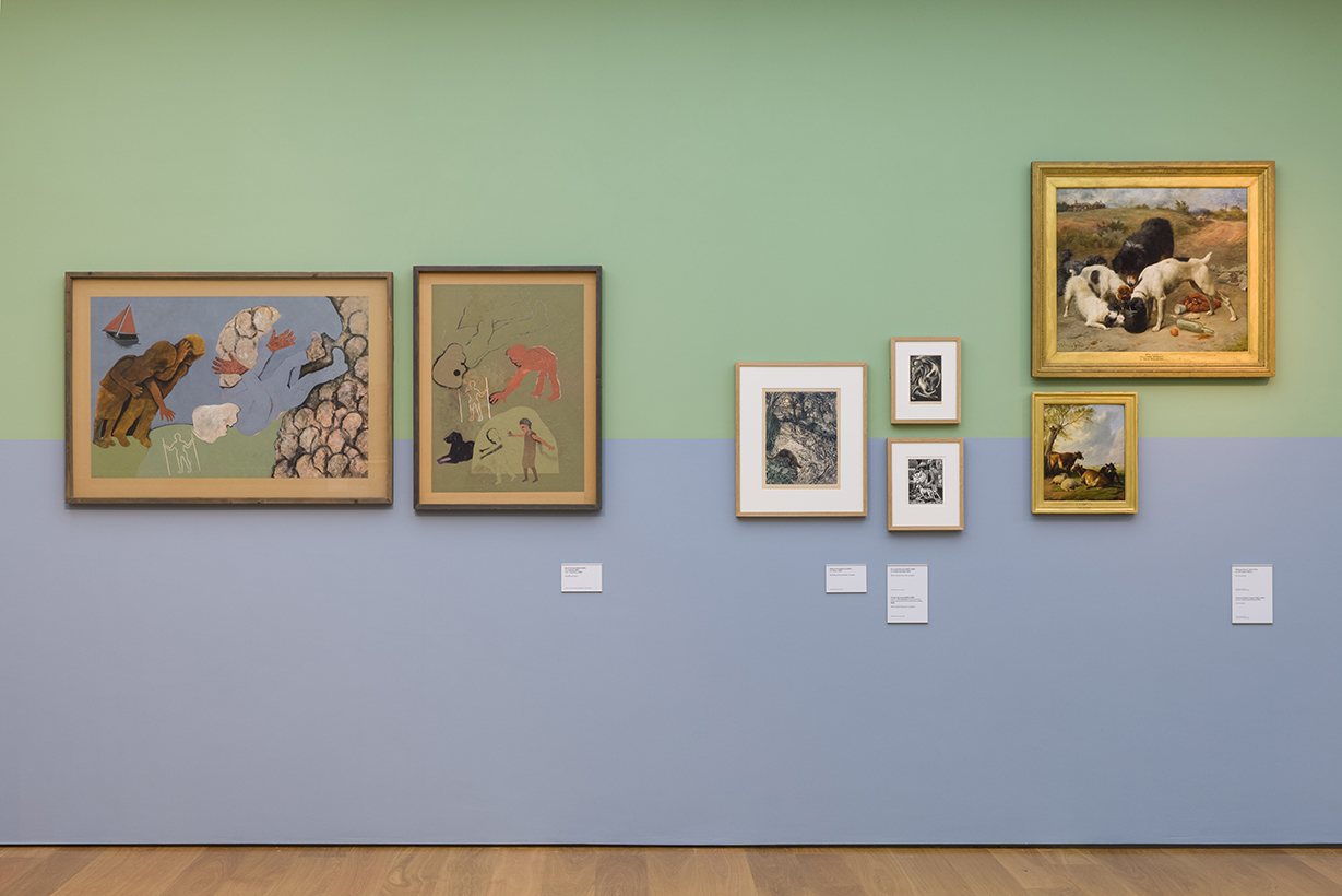
In our latest Towner Collection show, artist Mariana Castillo Deball (b.1975) delved deep into the Towner Collection to discover works that have rarely been displayed and has presented these alongside familiar and much-loved depictions of the Sussex landscape.
Castillo Deball was instantly drawn to Leslie Moffat Ward’s The Long Man of The Downs, 1943, a modest print of the larger-than-life hill figure. This print is central to the exhibition and continues her fascination with geoglyphs — large-scale drawings in the landscape that have informed her England’s Creative Coast Commission here in Eastbourne.
Interventions in the landscape, real and imagined, are a theme that runs through her selection, ranging from mysterious hill figures to depictions of the land as an agricultural environment that has been engineered and shaped over centuries. Harold Mockford’s Eastbourne, 1958, and John Lake’s Land and Sea reveal a latticework of fields and interlocking streets from an aerial perspective. Closer to earth, Val M. Ewens has captured a sense of pattern in the obedient crops of Midday Harvest and Harvest Completed, both 1978.
Landscape is explored as a symbolic territory that is constantly being altered, manipulated, and harvested, this concept is reflected in Tom Phillips’s A Humument. In an endeavour spanning fifty years, Phillips drew, painted, and collaged over the pages of a Victorian novel to create a new story within the story, with a new protagonist.
Animals are often omitted from depictions of the countryside, they have been reintroduced here through a variety of works featuring agricultural animals, domestic pets, and their human companions, including Kathleen Walne’s Girl with Cat, and Gertrude Hermes’s Fighting Dogs, 1924.
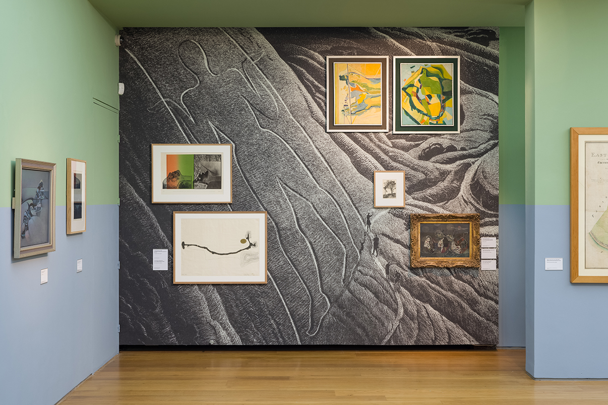
A drawing, a story-and a poem go for a Walk: Mariana Castillo Deball curates the Towner collection, photo Rob Harris
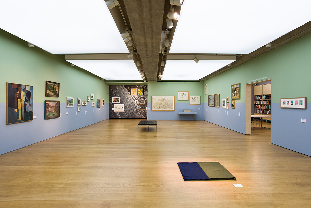
A drawing, a story-and a poem go for a Walk: Mariana Castillo Deball curates the Towner collection, photo Rob Harris
A drawing, a story-and a poem go for a Walk: Mariana Castillo Deball curates the Towner collection, photo Rob Harris
A drawing, a story-and a poem go for a Walk: Mariana Castillo Deball curates the Towner collection, photo Rob Harris
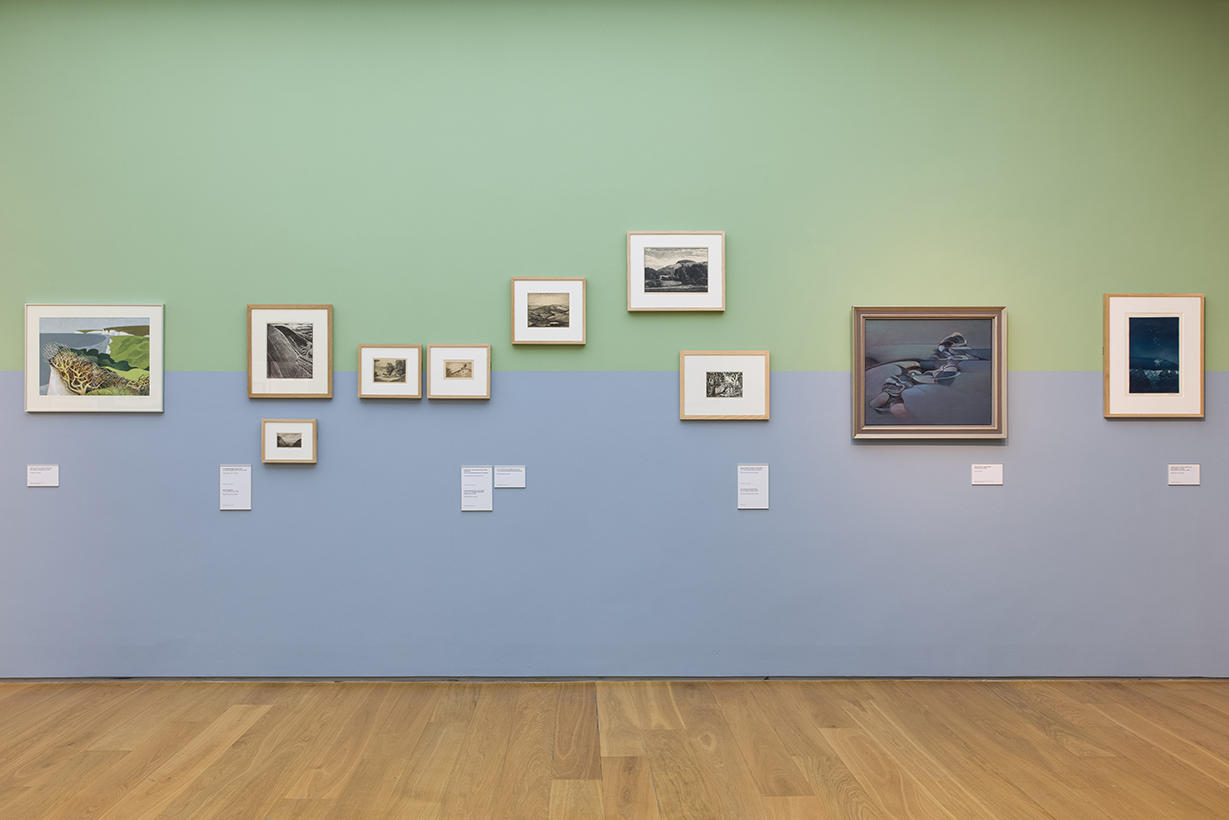
A drawing, a story-and a poem go for a Walk: Mariana Castillo Deball curates the Towner collection, photo Rob Harris
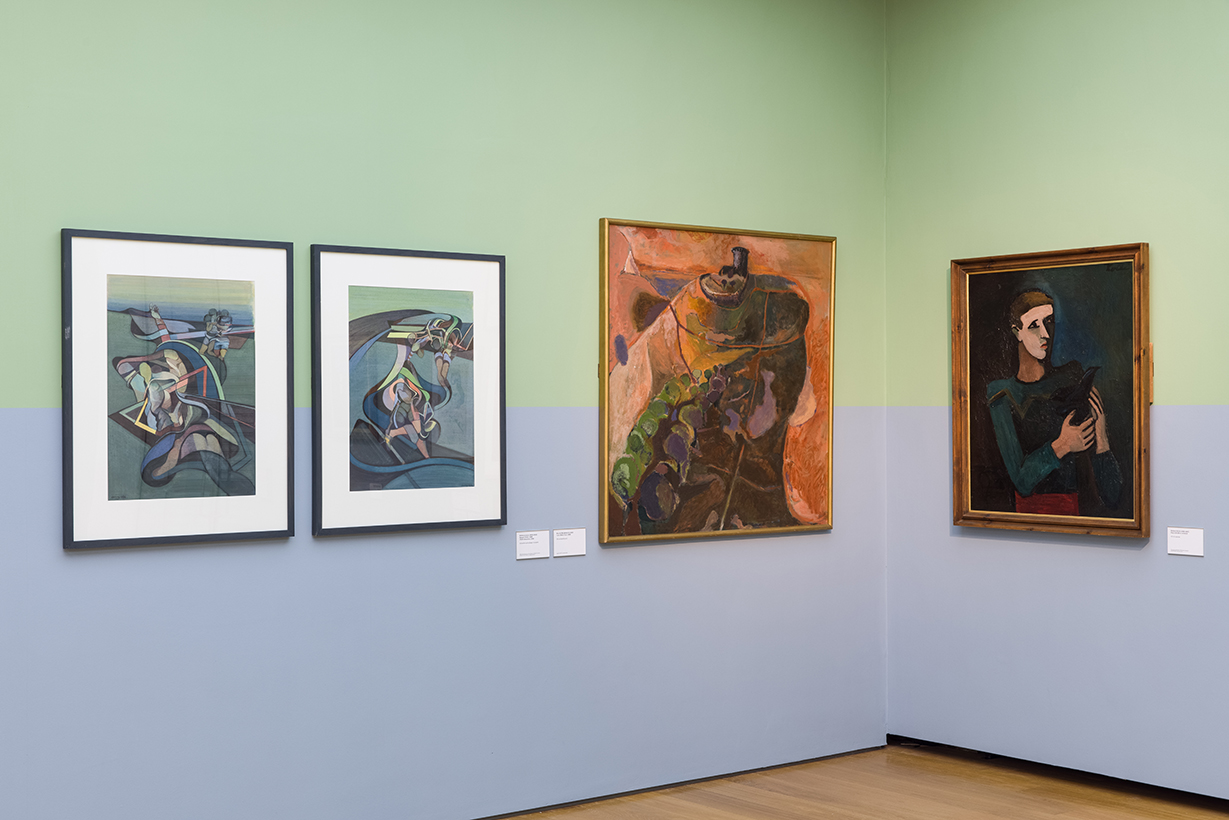
A drawing, a story-and a poem go for a Walk: Mariana Castillo Deball curates the Towner collection, photo Rob Harris
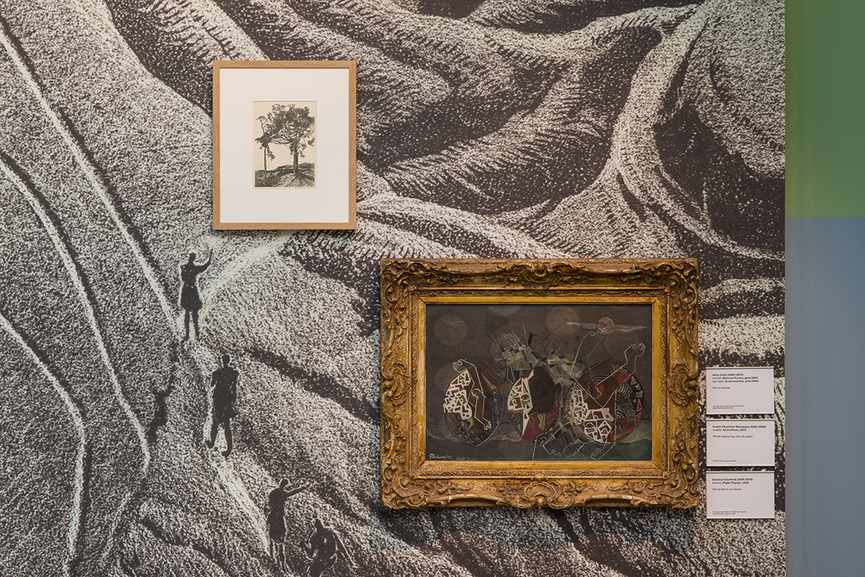
A drawing, a story-and a poem go for a Walk: Mariana Castillo Deball curates the Towner collection, photo Rob Harris
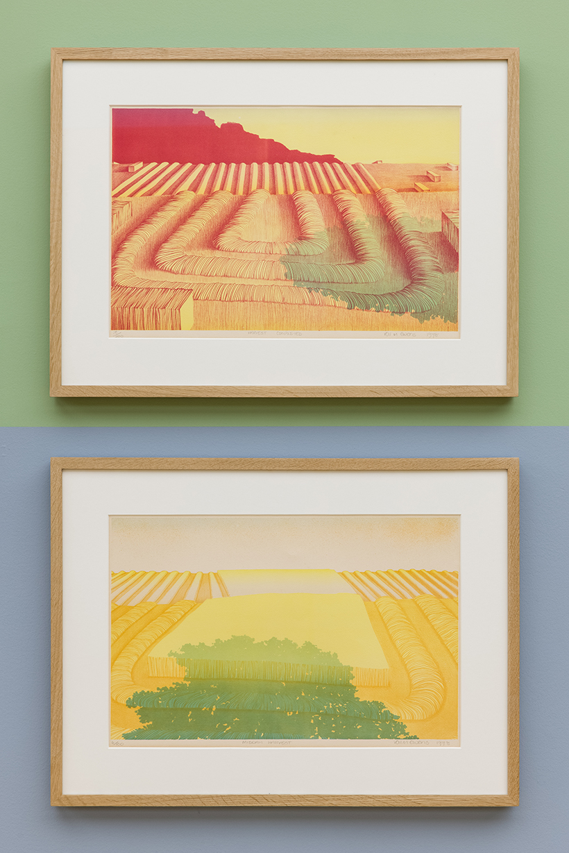
A drawing, a story-and a poem go for a Walk: Mariana Castillo Deball curates the Towner collection, photo Rob Harris
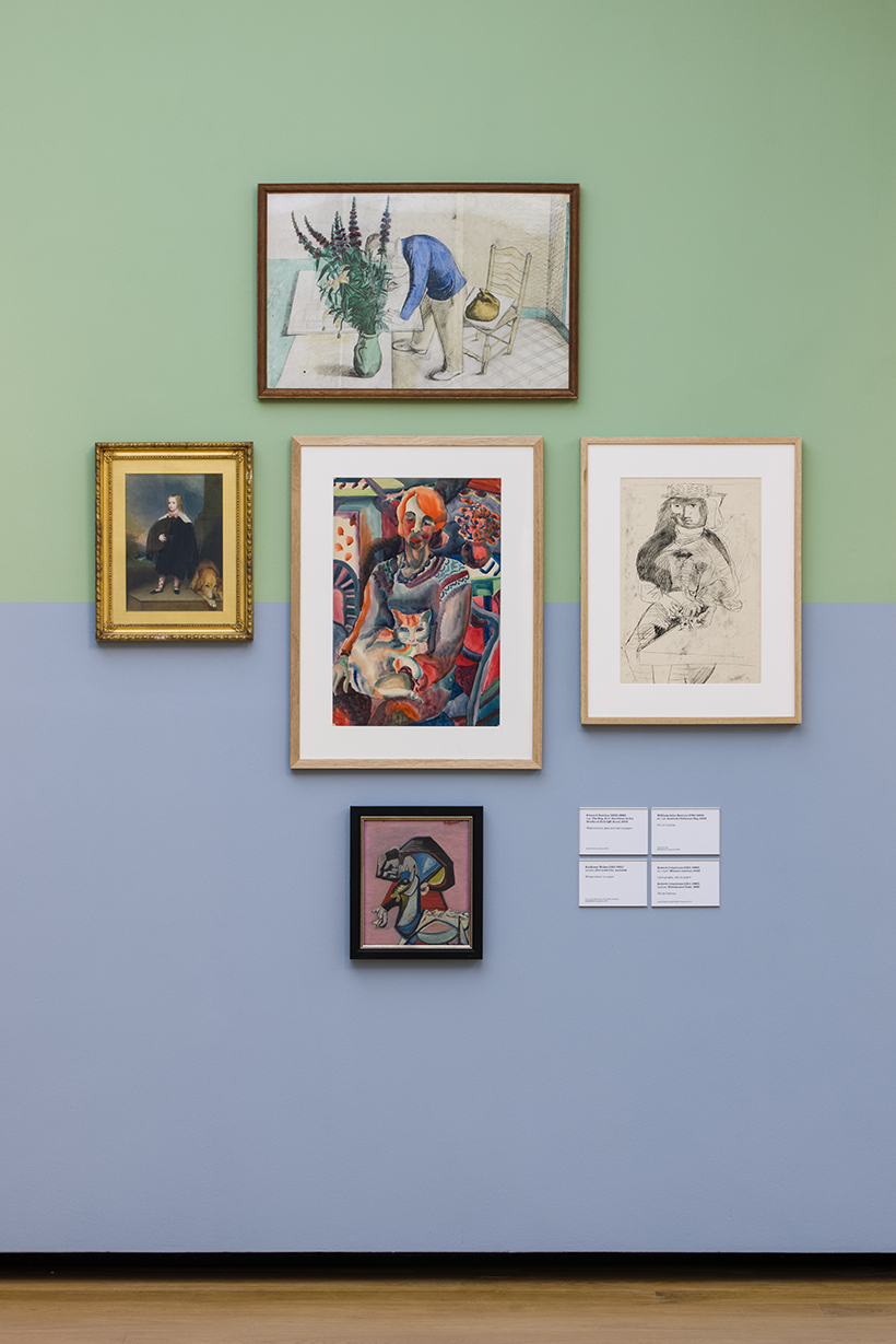
A drawing, a story-and a poem go for a Walk: Mariana Castillo Deball curates the Towner collection, photo Rob Harris
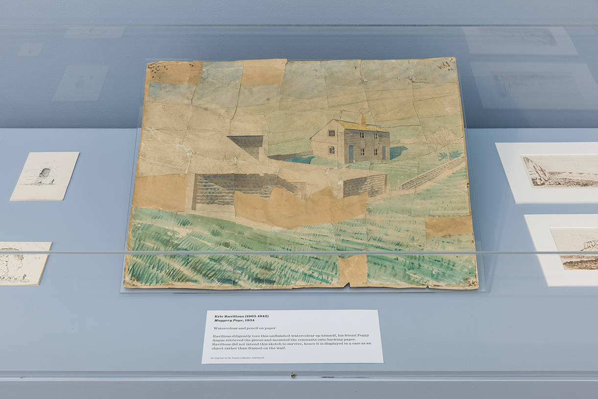
A drawing, a story-and a poem go for a Walk: Mariana Castillo Deball curates the Towner collection, photo Rob Harris
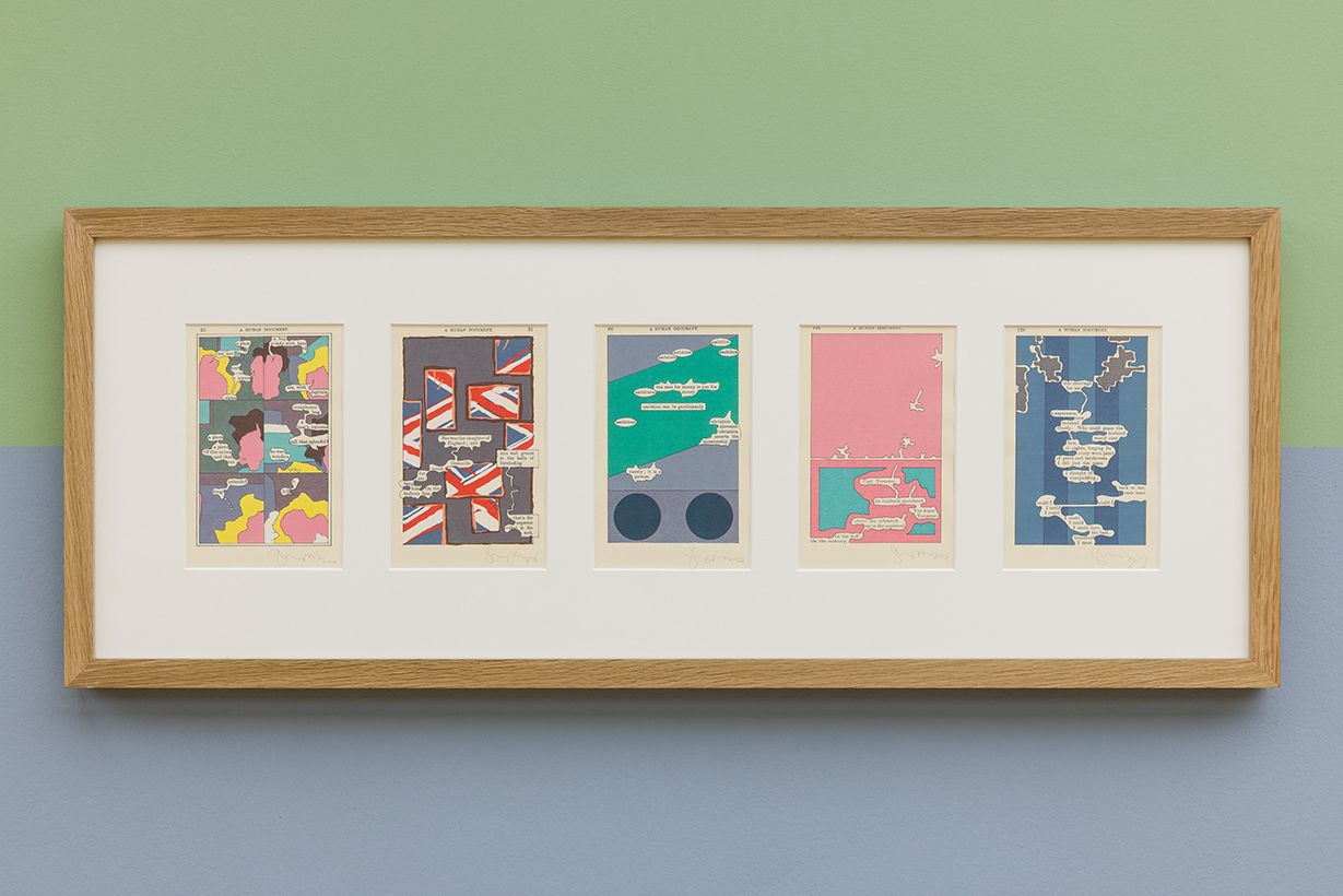
A drawing, a story-and a poem go for a Walk: Mariana Castillo Deball curates the Towner collection, photo Rob Harris
Forbidden symmetries
permanent installation at Rathausumfeld Wedding, Berlin-Mitte, Germany
Floor piece consisting of 45 concrete tiles, based on Penrose tiles, which conform both a pattern and an ornamental map. Symmetrical shapes such as rectangles and triangles can cover a plane with neither gap nor overlap, and in an ever-repeating pattern. Repeated patterns are called “periodic” because even if you move a pattern from place to place, it looks always the same. The British mathematician Roger Penrose tried to imagine a set of tiles that could be used to cover an infinite plane in a pattern that never repeats. To be precise, he was interested in “aperiodic” tiling, a set of tiles that could cover an infinite plane, without the tiling pattern ever repeating itself. That was a challenge because he couldn’t use tiles with two, three, four, or six axes of symmetry—rectangles, triangles, squares, and hexagons—because on an infinite plane they would result in periodic patterns. That meant he had to rely on shapes believed to leave gaps in the tiling of a plane—those with forbidden symmetries.
Tiling based on a pentagon was thought impossible, a forbidden symmetry, but in the early 1970’s, Roger Penrose discovered that a surface can be completely tiled in an asymmetrical, non-repeating manner with just two shapes based on phi, now known as “Penrose tiles.” What is special about Penrose tiles is that even though he derived his tiles from the lines and angles of pentagons, his shapes leave no gaps.
They snug together perfectly, twisting and turning across the plane, always coming close to repetition, but never quite getting there. This is accomplished by creating a set of two symmetrical tiles, each of which is the combination of the two triangles found in the geometry of the pentagon. Based a set of Penrose tiles, I developed a series of ornamental tiles to depict a modular topography, an imaginary landscape.
By creating an ornament following the rules of the Penrose tile, the pattern becomes alive, and allows the viewer to get lost in the intricate possibilities.Thanks to the ornament, we can wander endlessly like a dance though the pattern. According to British anthropologist Alfred Gell, complex patterns, by their multiplicity and the difficulty we have in grasping their mathematical basis by mere visual inspection, generate relationships over time between persons and things, because what they present to the eye is, cognitively speaking, always unfinished business.
The ornament complexity exceeds the viewer’s ability to organize the visual field, entrapping him in a kind of cognitive limbo, in never ending exchange. Gell describes this capacity of visual patterns as ‘cognitive sickness, the pleasurable frustration of the eye being trapped within a rhythmic surface, the mazy dance in which our eyes become lost.
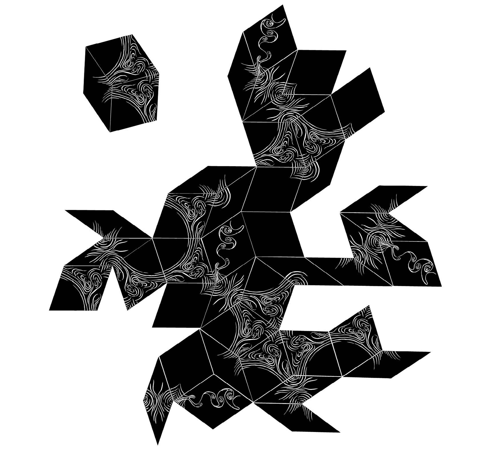
Sketch: Forbidden symmetries
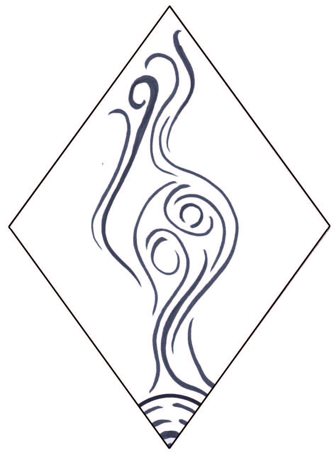
Sketch: Forbidden symmetries
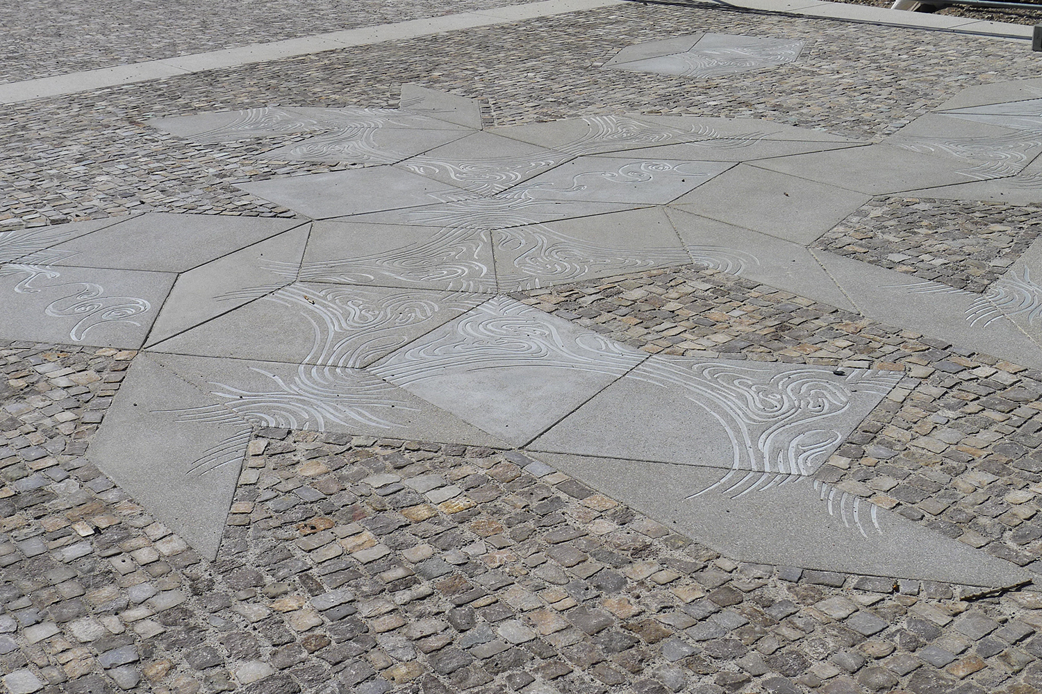
Forbidden symmetries, 2015, concrete tiles
Freiraumgestaltung Rathausumfeld Wedding in Berlin-Mitte, Germany
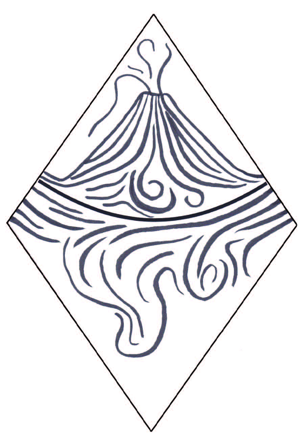
Sketch: Forbidden symmetries
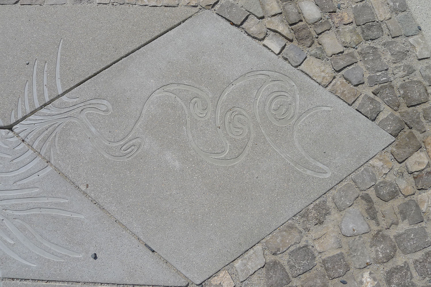
Detail: Forbidden symmetries, 2015, concrete tiles
Freiraumgestaltung Rathausumfeld Wedding in Berlin-Mitte, Germany
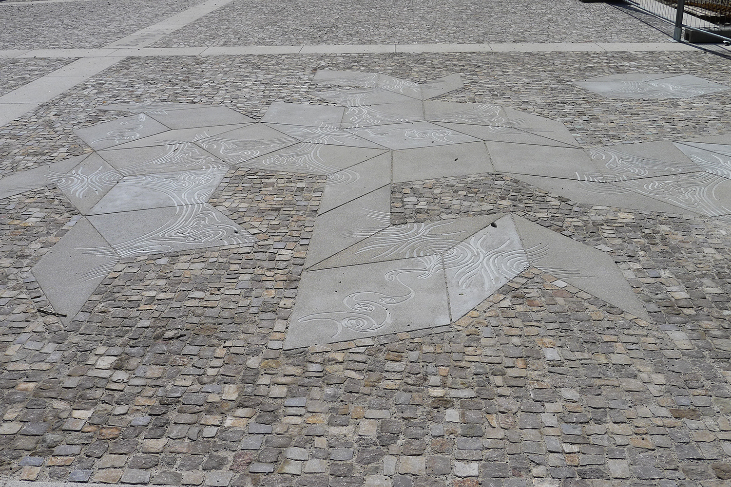
Forbidden symmetries, 2015, concrete tiles
Freiraumgestaltung Rathausumfeld Wedding in Berlin-Mitte, Germany
The Mapping Impulse
permanent installation at the Noord-Hollands Archief, Haarlem, The Netherlands, 2007.
“There is a fundamental dichotomy between the art of the Italian Renaissance and that of the Dutch masters: Italian art is the primary expression of a “textual culture”, this is to say of a culture which seeks emblematic, allegorical or philosophical meanings in a serious painting. The world of Dutch art, on the contrary, arises from and enacts a truly “visual culture”. It serves and energises a system of values in which meaning is not “read”, but “seen”, in which new knowledge is visually recorded.”
Svetlana Alpers, The Art of Describing: Dutch Art in the Seventeenth Century
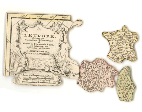
L’Europe suivant les nouvelles observations de Messrs de l’Academie Royale des Sciences Augmentées de Nouveau
Jigsaw Puzzle. Map of Europe.
Amsterdam, Covens & Mortier ca., 1750, 30 x 22,5cm.
Several things attracted my attention during the visits to the Noord-Hollands archief and the city of Haarlem, but there is a constant, which can be compared to what Svetlana Alpers defines as “The Mapping impulse in Dutch art”.
It is not a coincidence that The Dutch were the first ones who produced maps as wall hangings and probably the first jigsaw puzzle (from a map). This shows only a part of the wide production, dissemination, and use of maps throughout the society. Mapping in the 16th century was a common, even a casually acquired skill. Each man made at least a single map in a lifetime. It seems to have been an accepted way to pay one’s respect to one’s home while contributing to the knowledge of it.
The Noord-Hollands Archief, and specially the Atlas section, contains a vast collection of maps, engravings, photographs and other visual material.After going through the cartography collection, it is striking to see how the countries landscape has been changing throughout the centuries. This development has two faces: the actual transformation of Dutch geography, in an attempt to gain land; and from the other hand, the quick development of cartography since the 16th century.
In the archive I could see thousands of drawings, maps and books defining and measuring land. Even the smallest piece of land has a value, a name and a use. There is also a constant exchange between water and land. Complicated plans show the drying systems and walls were made to stop the water.
In my proposal, I am working with the following elements:
a) Map making and the development of Dutch geography.
b) Defining space, exchanging values: The metaphor of the jigsaw puzzle is appropriated in the sense that water and land have been cutout, exchanged and divided, specially in the north of Holland.
c) Wind roses: signatures of the cartographers
The proposal is based in a series of carved panels made out of different materials: stone, wood and paper.Some of the carvings stand on their own if the material allows it, the fragile ones, is installed like a sandwich, between glasses.
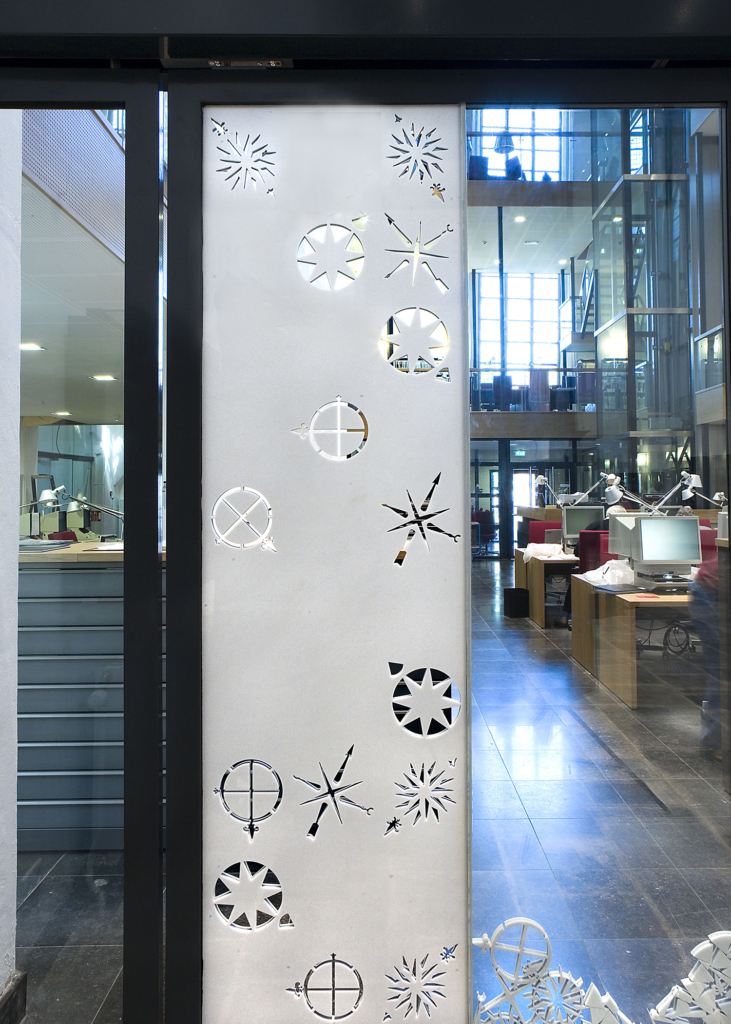
Detail: The Mapping Impulse, 2007
Steel, aluminium, wood, marble, blue limestone and glass
Noord-Hollands Archief, Haarlem, The Netherlands
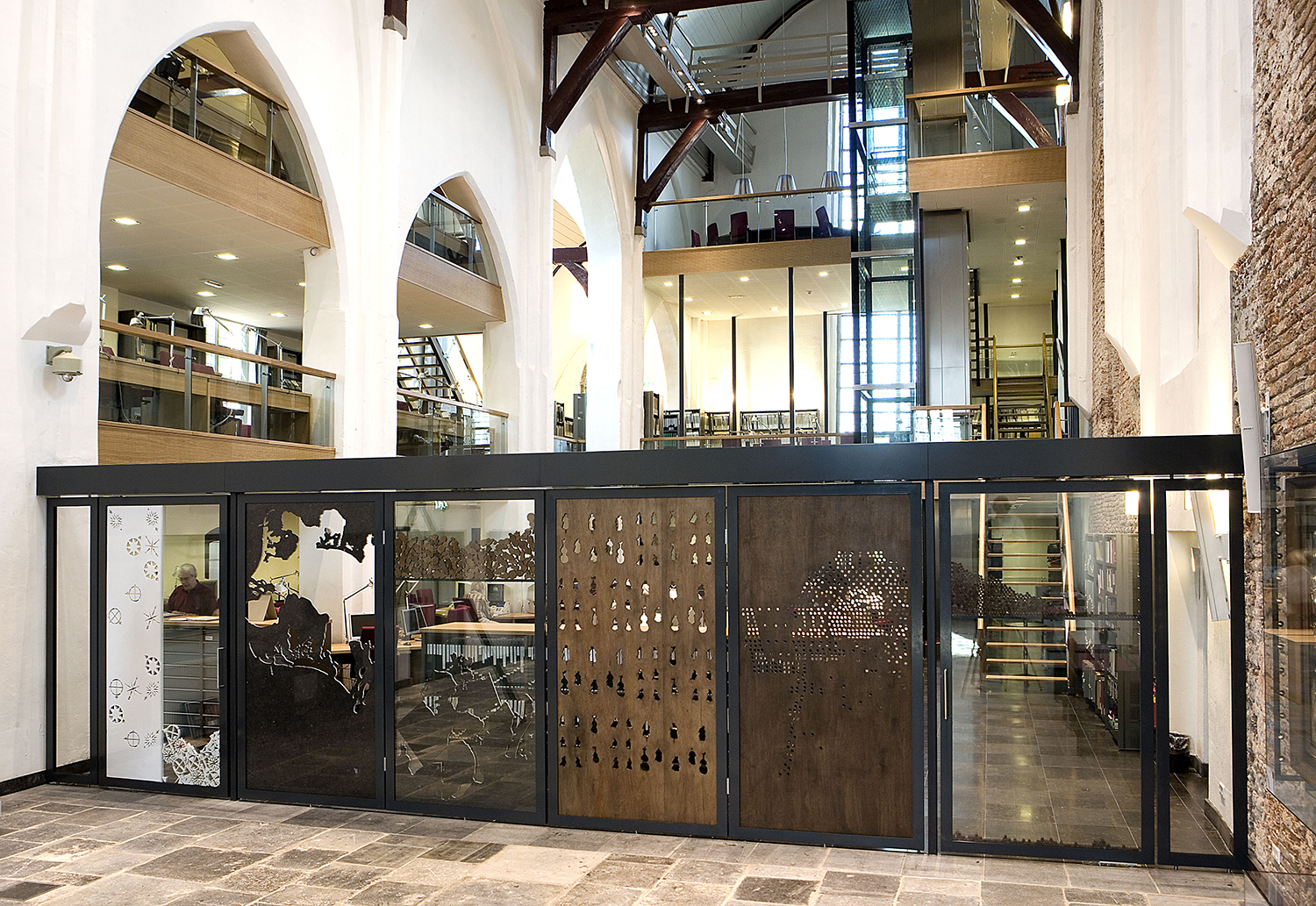
The Mapping Impulse, 2007
Steel, aluminium, wood, marble, blue limestone and glass
Noord-Hollands Archief, Haarlem, The Netherlands
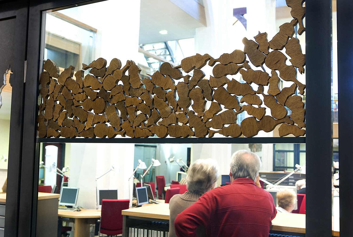
Detail: The Mapping Impulse, 2007
Steel, aluminium, wood, marble, blue limestone and glass
Noord-Hollands Archief, Haarlem, The Netherlands
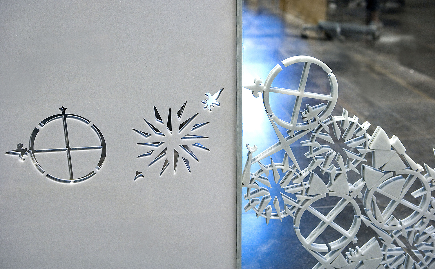
Detail: The Mapping Impulse, 2007
Steel, aluminium, wood, marble, blue limestone and glass
Noord-Hollands Archief, Haarlem, The Netherlands
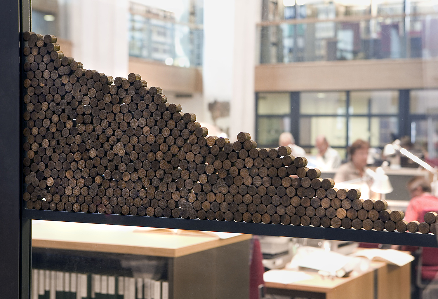
Detail: The Mapping Impulse, 2007
Steel, aluminium, wood, marble, blue limestone and glass
Noord-Hollands Archief, Haarlem, The Netherlands